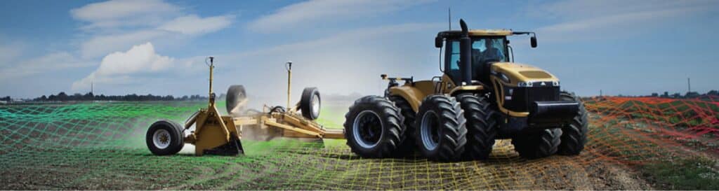
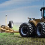
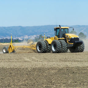
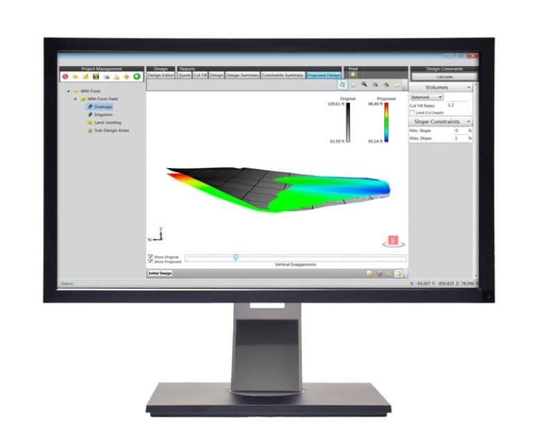
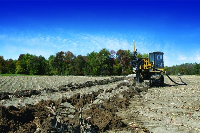
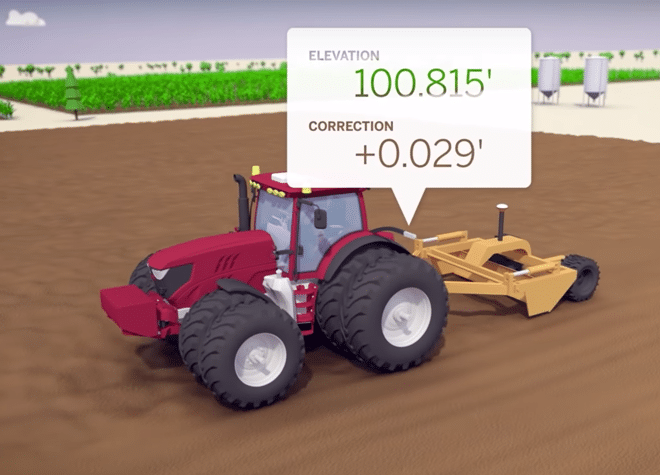
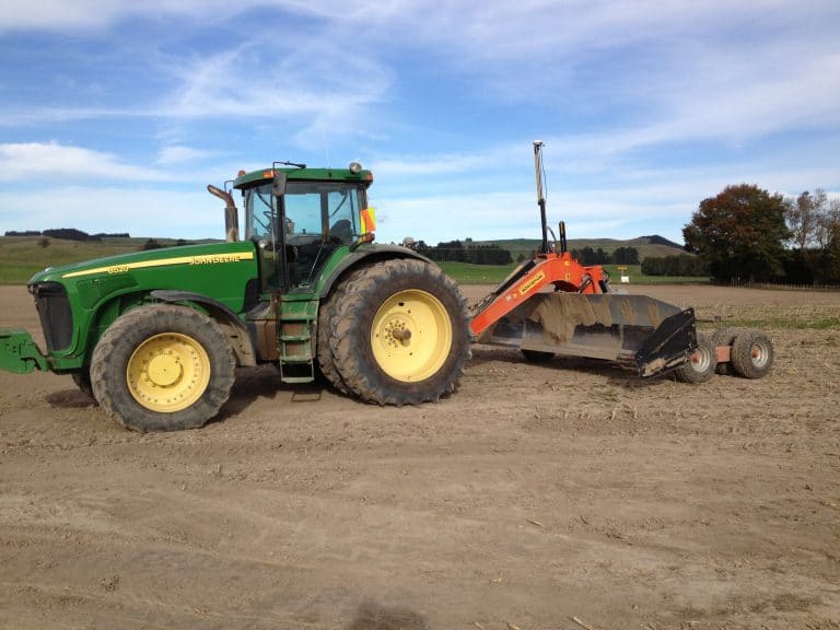
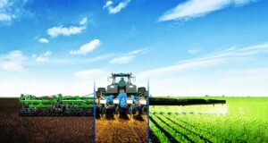
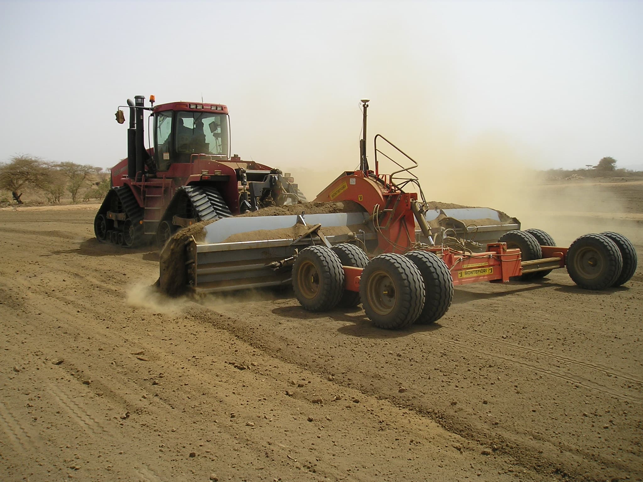
The Trimble® FieldLevel™ II system streamlines the surveying, designing, and leveling steps required for land leveling projects. It also provides two methods for installing rice levees.
FieldLevel II helps ensure optimal water management by providing improvements in yields, water usage, and farm productivity.
FEATURES:
Efficiently distribute water by maintaining grade
Improve yields by controlling excess water
Minimize water costs and improve farm productivity
Survey: Precisely map your fields; create boundaries, interior points, and surfaces with ease; and calculate and report on the true acreage of your survey area for optimal field coverage and accurate surface designs.
Design: Create a best-fit surface using Autoplane technology; define primary and cross slopes for prescribed orientation and grades; and utilize Multiplane design software for more complex field requirements.
Level: Automatically drive the scraper hydraulic valves on any type of tractor and scraper to level your fields. You can also operate both tandem and dual scraper systems to increase the productivity of your leveling projects.
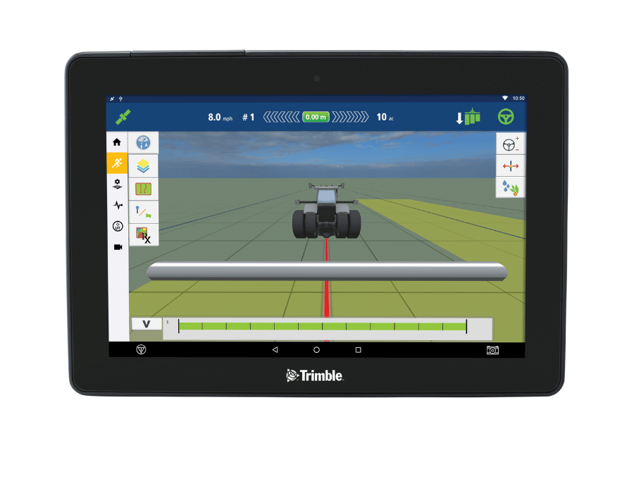
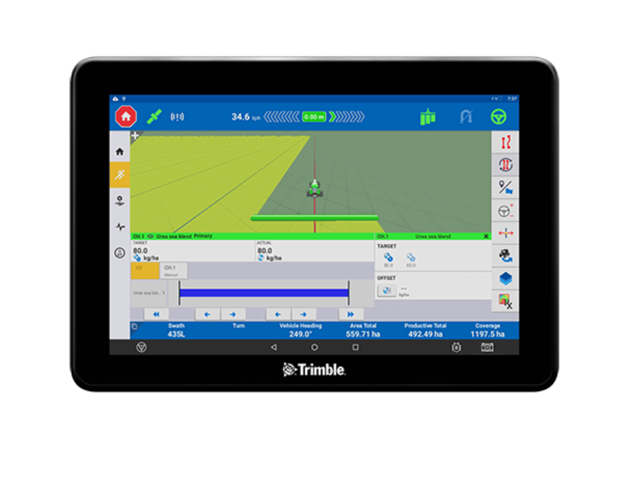
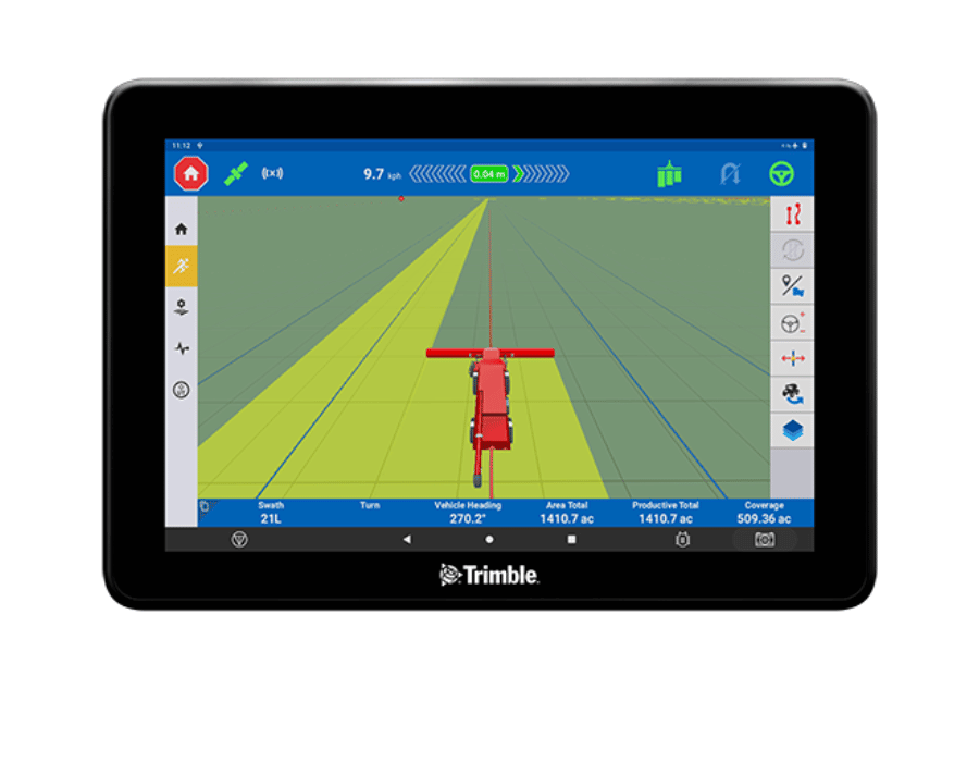
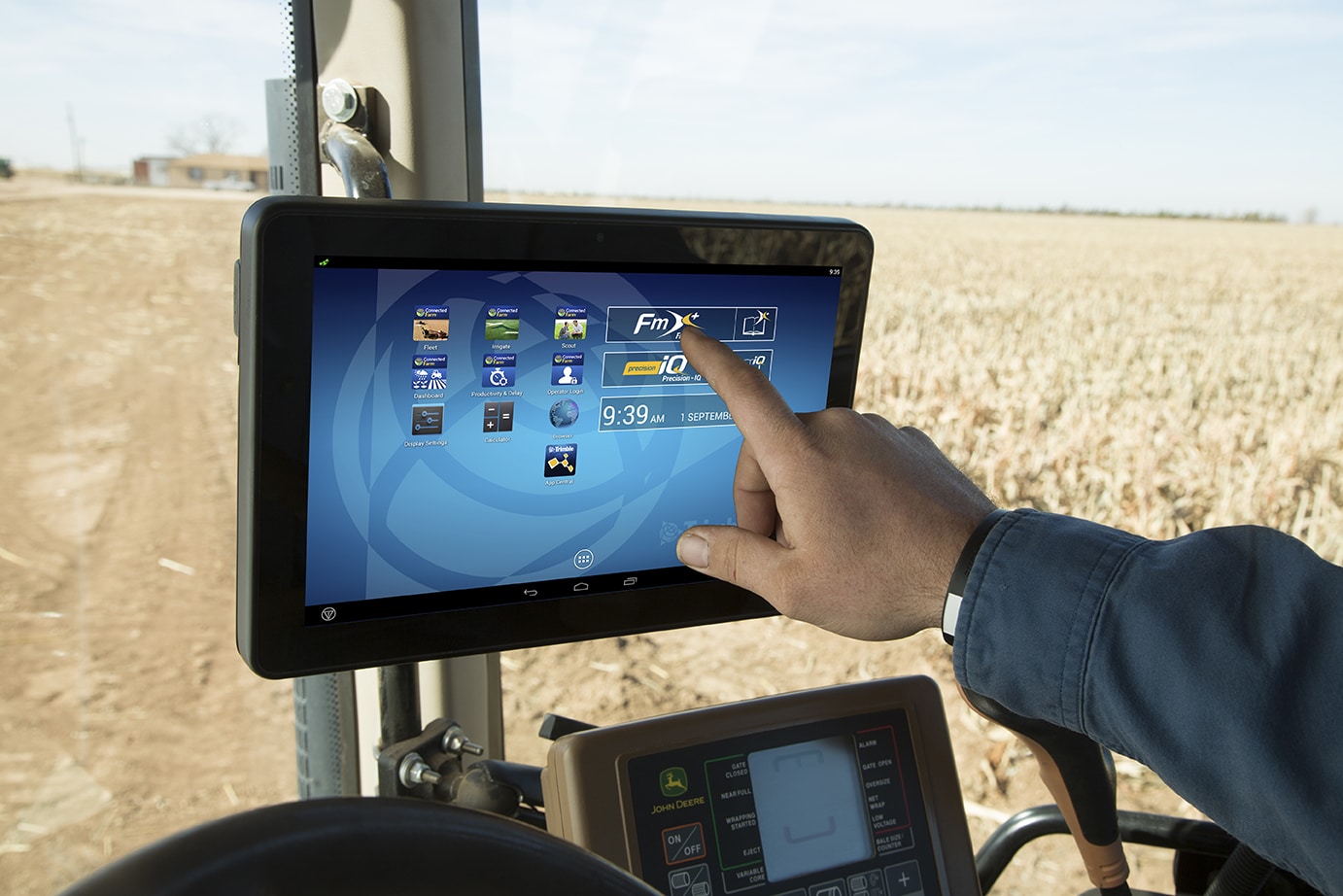
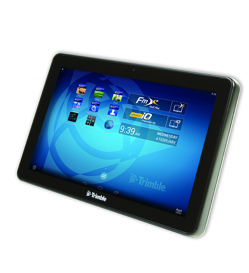
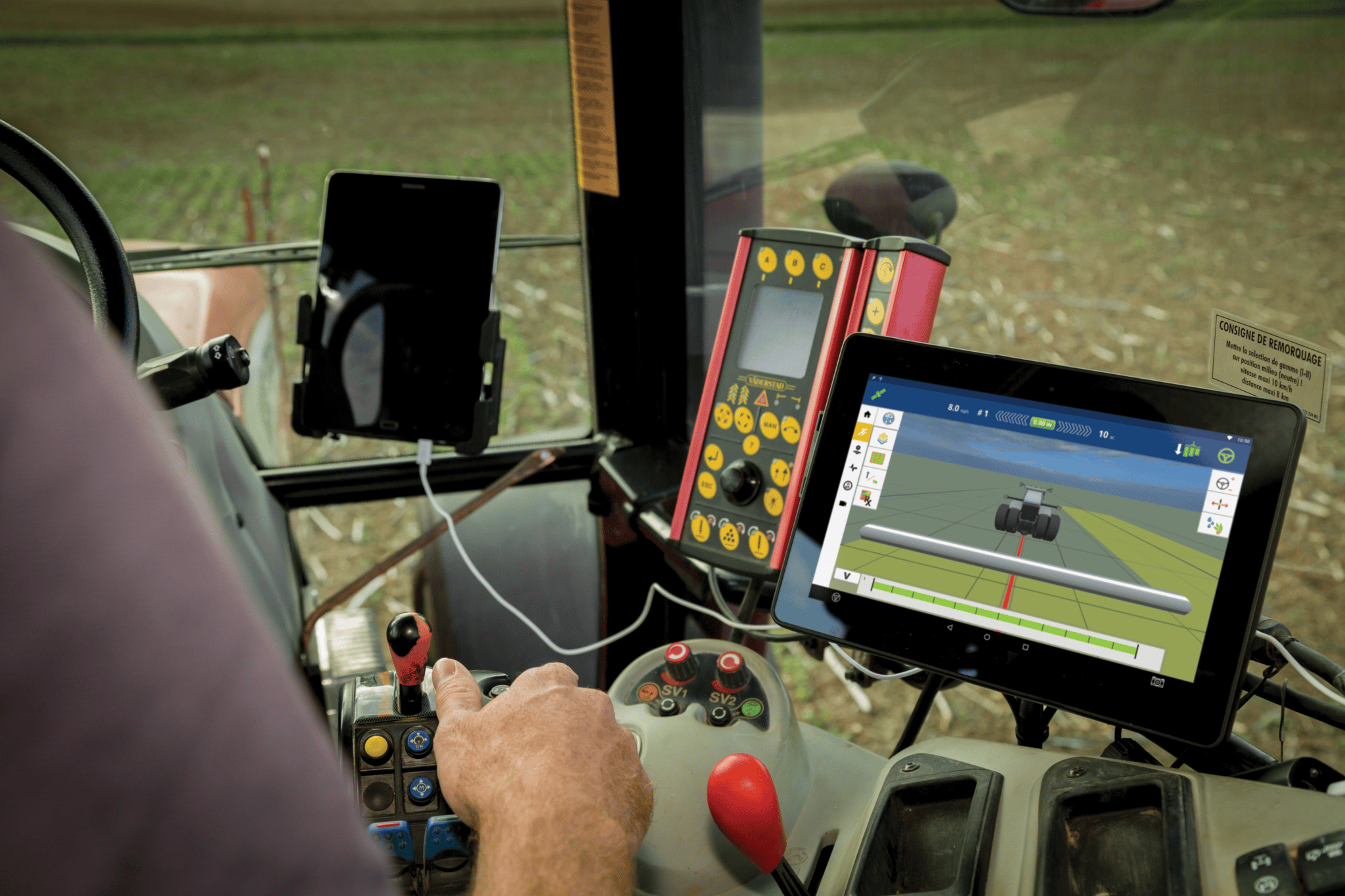
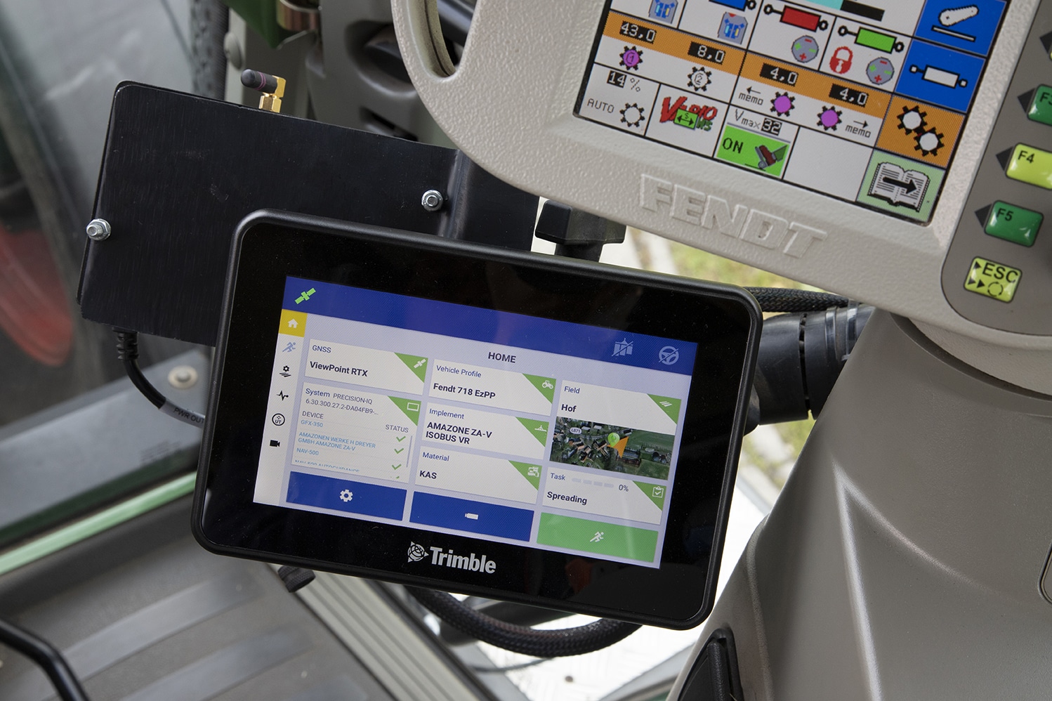
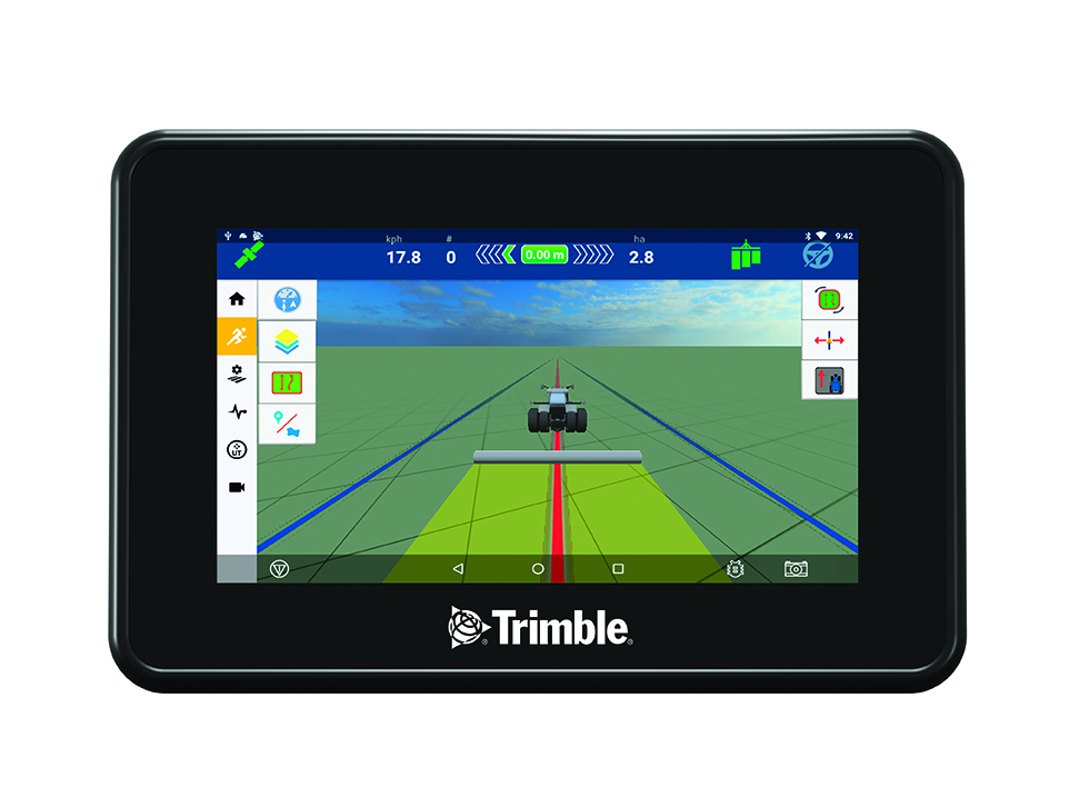
In the middle of a busy season, the last thing you need is a complicated interface. The easy-to-use TMX-2050™ display system features a large high-definition touch screen with sharp visuals and a choice of FmX® Plus or Precision-IQ™ display applications to suit your specific farm practices.
The Trimble® TMX-2050™ display lets you work even smarter. Take control of your entire operation with a system that gives you the clarity, certainty, and connectivity you need. Because your business is too important to leave to chance.
FEATURES:
Large 12.1” (30.8 cm) high-definition color touch-screen display
Android-based operating system allows you to customize the display for the way you work
Rugged construction for everyday field use, meeting demands in harsh environments
One integrated GNSS receiver
One integrated camera with support for an additional external camera
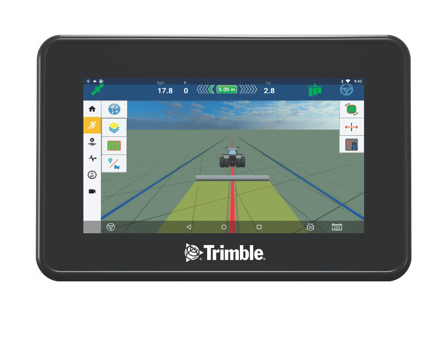
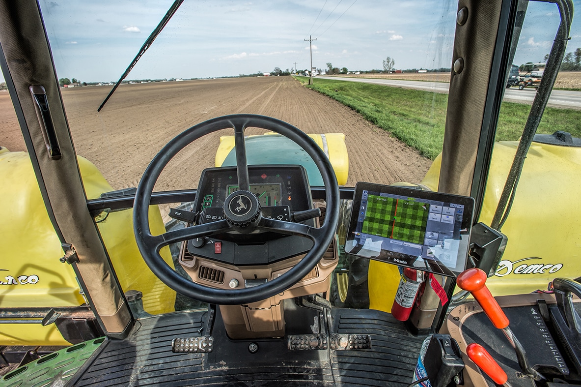
The Trimble® GFX-750™ display system continues a strong tradition of sleek, easy-to-use displays from Trimble Agriculture. With a roof-mounted guidance controller, your cab will be clean and clutter free with this automated guidance system.
Add in Bluetooth® and Wi-Fi connectivity to go along with ISOBUS compatibility and any grower can tackle farming applications from every season across all equipment brands.
FEATURES:
Large 10.1″ (25.6 cm) high-definition colour touch-screen display
Android-based operating system allows you to customize the display for the way you work
Rugged construction for everyday field use, meeting demands in harsh environments
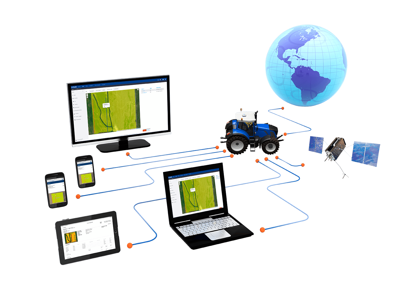
Connect, simplify, and streamline your entire farm operation with Farmer Core. Trimble’s Farmer Core software complements your existing Trimble system to manage precision farming data and simplify display setup to capture the most value from every acre.
Farmer Core is powered by AutoSync™, a new and innovative feature that runs in the background to automatically sync all guidance lines, field names, boundaries, materials, implements, vehicles, and operator information across all connected devices.
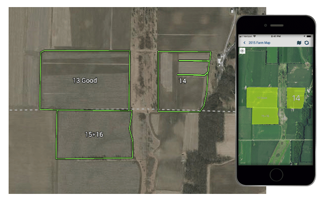
Create client/farm/field names, import or draw field boundaries, and set up materials manually or by using a pre-built list of chemicals and seeds.
Streamline Farm Operations:
Manage precision farming data from Trimble displays and other sources via API, keeping all of your guidance lines, field names, materials, and machine information in one place.
Improve Reliability of Farm Records:
Automatically create field records based on data collected with your precision farming display to generate an easy-to-understand profitability analysis for each field
More Than Just Pretty Maps:
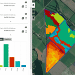
Are you tired of looking at yield maps that don’t match what’s in the field? Trimble Ag Software’s new Yield Data Cleaning tool automatically fixes issues with grain flow delays, GPS errors, sensor errors, and overlaps, saving you countless hours manually fixing them field-by-field. As more and more farmers move toward precision ag, accurate yield maps become critical when using them for prescriptions or management zones. Clean yield data means accurate maps, which result in more profitable acres.
Work Orders:
Designed to streamline farm workflows, Farmer Core’s Trimble Display Work Orders are a set of instructions for completing in-field tasks that are created on the web, and will then sync to the Precision-IQ display to facilitate remote task setup. This allows users to define details including materials, fields, implements, and operators for a Precision-IQ display task before they even get in the cab. After an operator completes the task in the Precision-IQ display, task status and data from the Work Order are wirelessly sent to Trimble Ag Software.
Fleet:
Customers with a Display Connection license can now utilize the full functionality of Fleet, such as tracking current and historical locations, vehicle utilization, and alerts — all of which are powered by FarmStream (using the FmX® integrated display, TMX-2050™ or GFX-750™ displays).
Users can:
Track equipment locations, status, and utilization
View historical positions
Capture time spent idling, moving, and traveling as well as monitor reasons for delays
Access engine diagnostics for real-time machine health
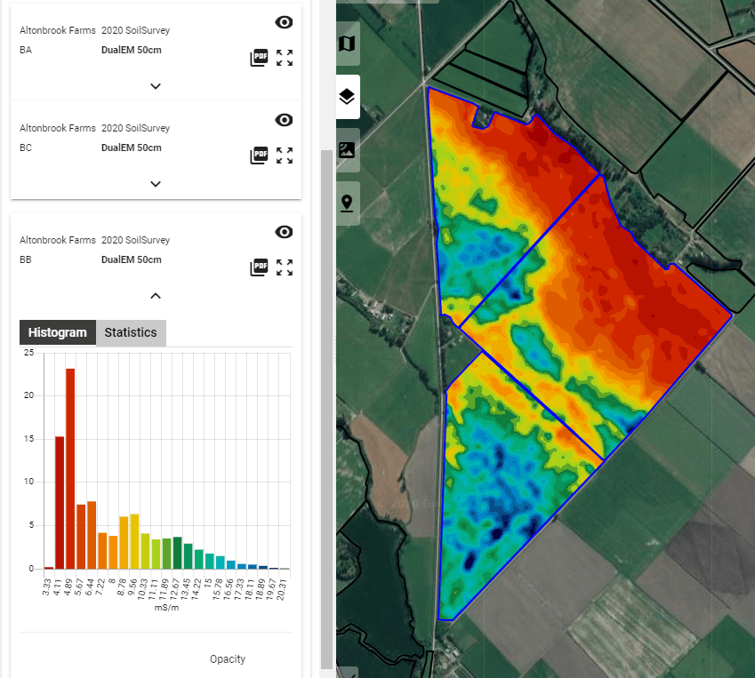
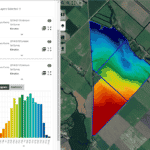
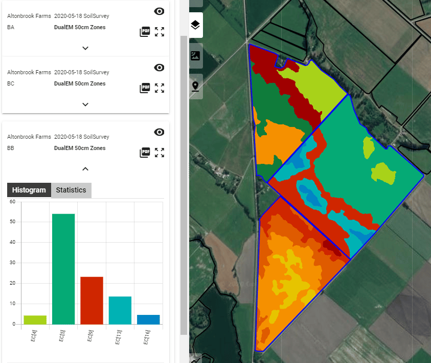
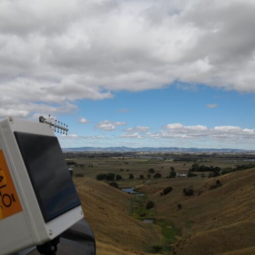
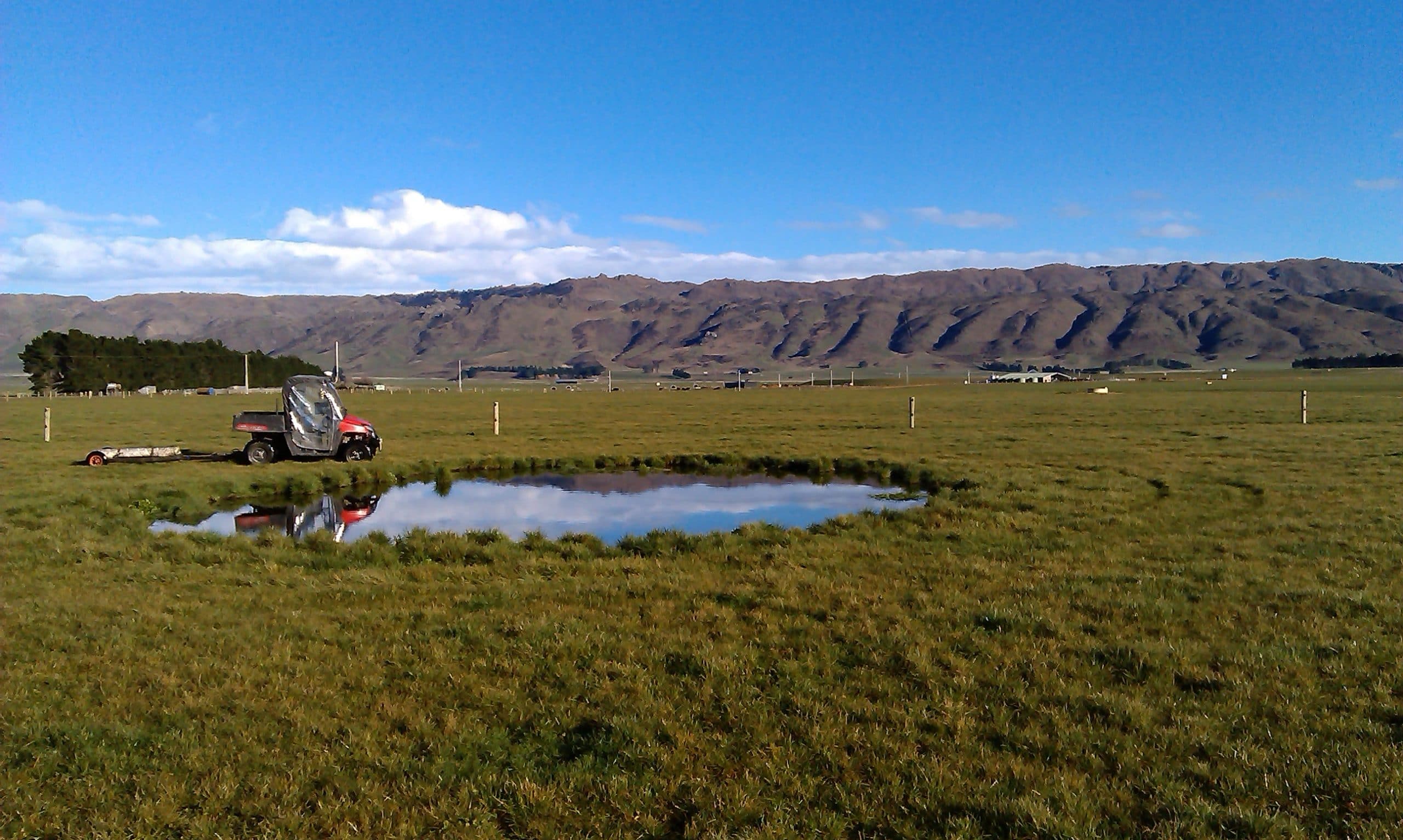
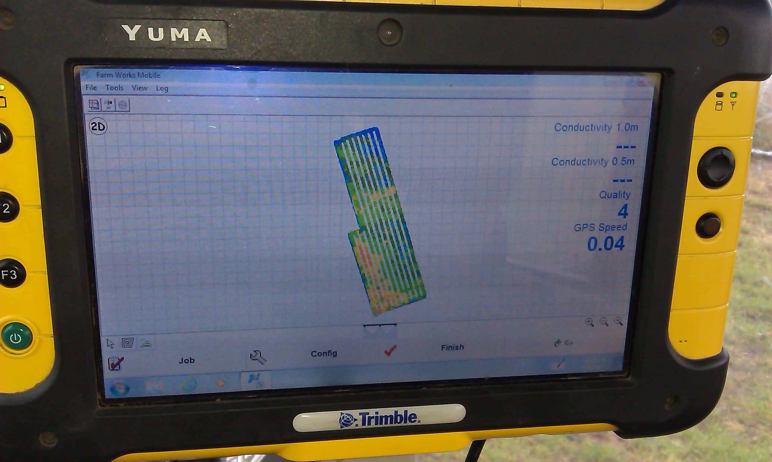
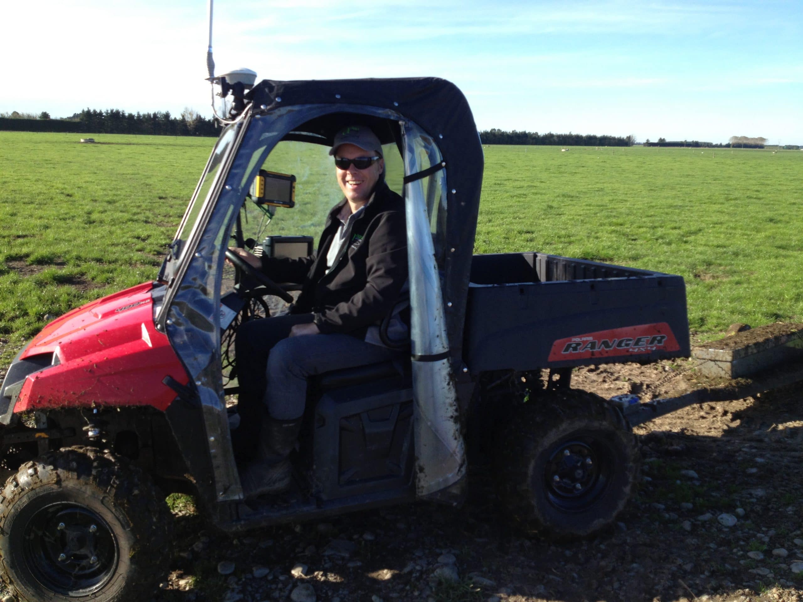
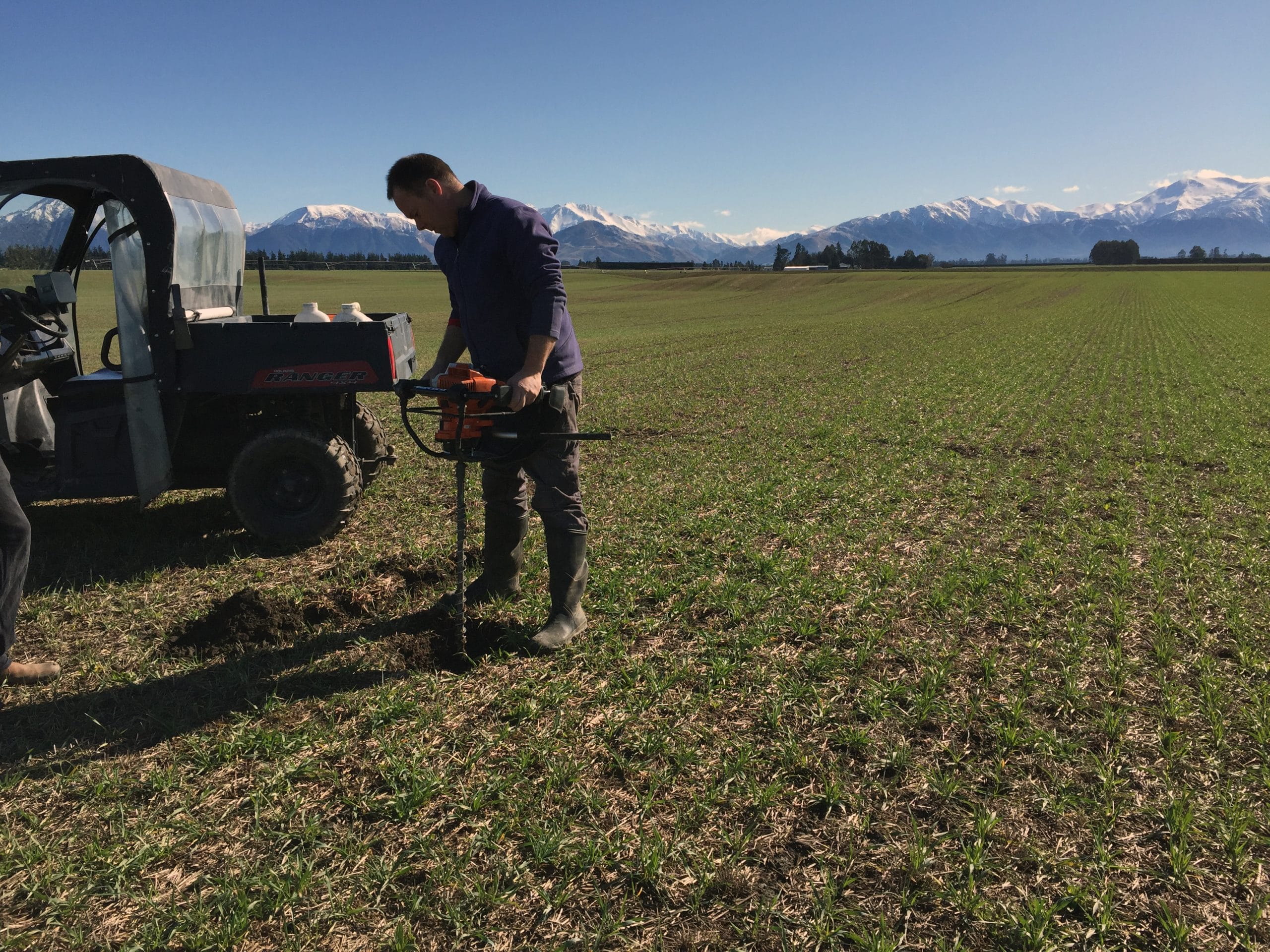
Imagine wanting to know more about the soil under your feet. Well, you can, by conducting an EM (Electro-magnetic) Survey across your paddock or farm. An EM conductivity survey measures and maps the variability in apparent electrical conductivity within the soil profile using sensors – without any requirement for soil-to-instrument contact. The measured conductivity can then be linked to different soil characteristics such as stone and clay content for zoning differing management zones.
At Vantage NZ we use EM technology across a range of different applications, from pastoral farming, to arable farming, to viticulture. While it is most widely used in agriculture in NZ, EM can also be used for applications in archeology and general soil science as it can explore up to a maximum depth of 1.5m.
FEATURES:
A great way to quantify the variability of your soils
Is one of the key pieces of information for starting a farm down their precision ag journey
Can be used for a wide range of variable rate applications – irrigation, fertilsier, seeding + more
An EM Survey is often a one-off survey, unless your soil profile changes significantly
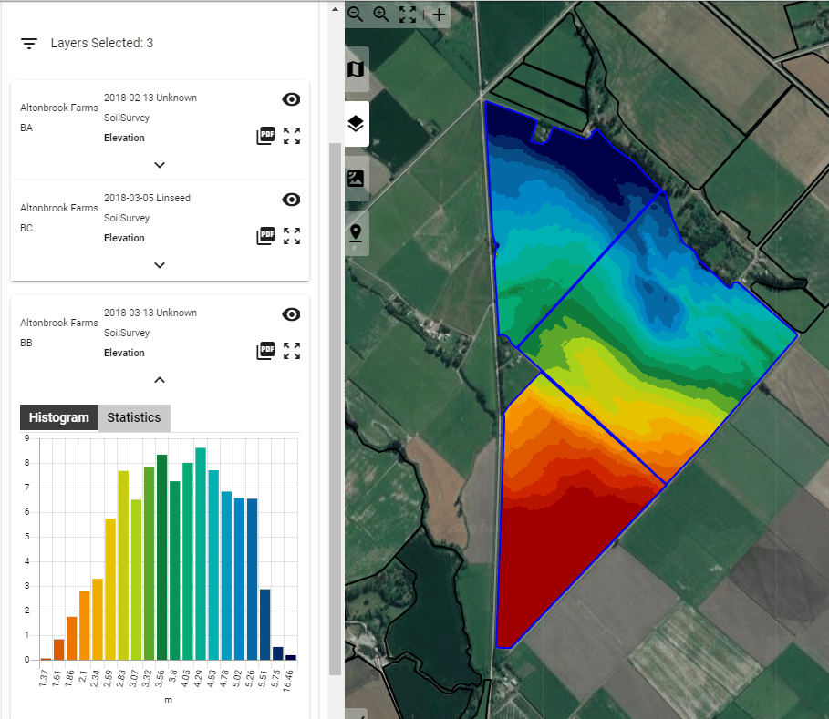
Topography information is also captured at the same time as a survey & can be used for watershed simulations and environmental management
EM Surveying works by emitting an electro-magnetic field into the soil. The strength of this magnetic field and how far it can travel through the soil profile is determined by the textural composition of the soil. The magnetic field is strongest about 30-40cm below the soil surface and has the ability to sense to a depth of about 1.5m when in the vertical mode. A receiving coil reads the induced currents in the soil and it is these currents that measure soil conductivity.
The usefulness of soil conductivity stems from the fact that sands have a low conductivity, silts have a medium conductivity and clays have a high conductivity. Consequently, conductivity (measured at low frequencies) correlates strongly to soil grain size and texture.
In addition to its ability to identify variations in soil texture, electrical conductivity has proven to relate closely to other soil properties that often determine a field’s productivity such as Cation exchange capacity (CEC), bulk density, water-holding capacity and salininty.
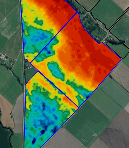
what do i get from an EM Survey?
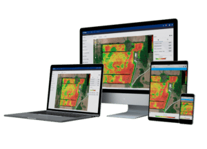
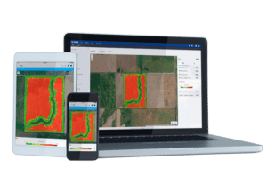
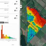
From an EM Survey with Vantage NZ you are supplied two highly detailed maps of your soil variability (0-50cm & 0-125cm) as well as a digital elevation model, slope, aspect & landscape change among other topographic derivatives. The survey results are available online through the PCT platform, so you can access your data and use it. We also supply you with a hard copy of your report and maps. These maps can then be further ground-truthed depending on their target application and used for zone management.
Benefit from a variety of accuracy levels with Trimble GNSS receivers for all your precision farming needs.
View the suite of receivers below.
Receivers
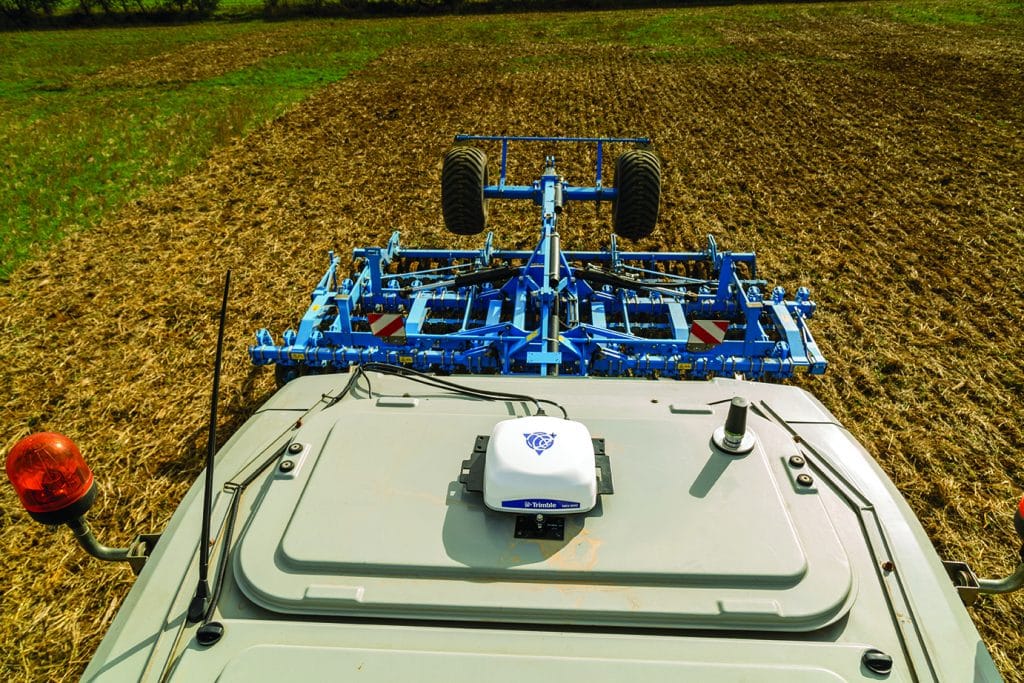
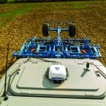
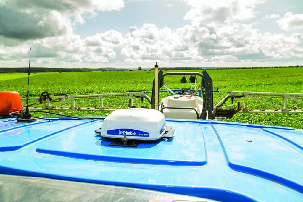
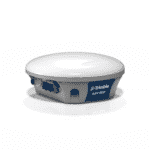
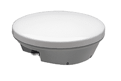
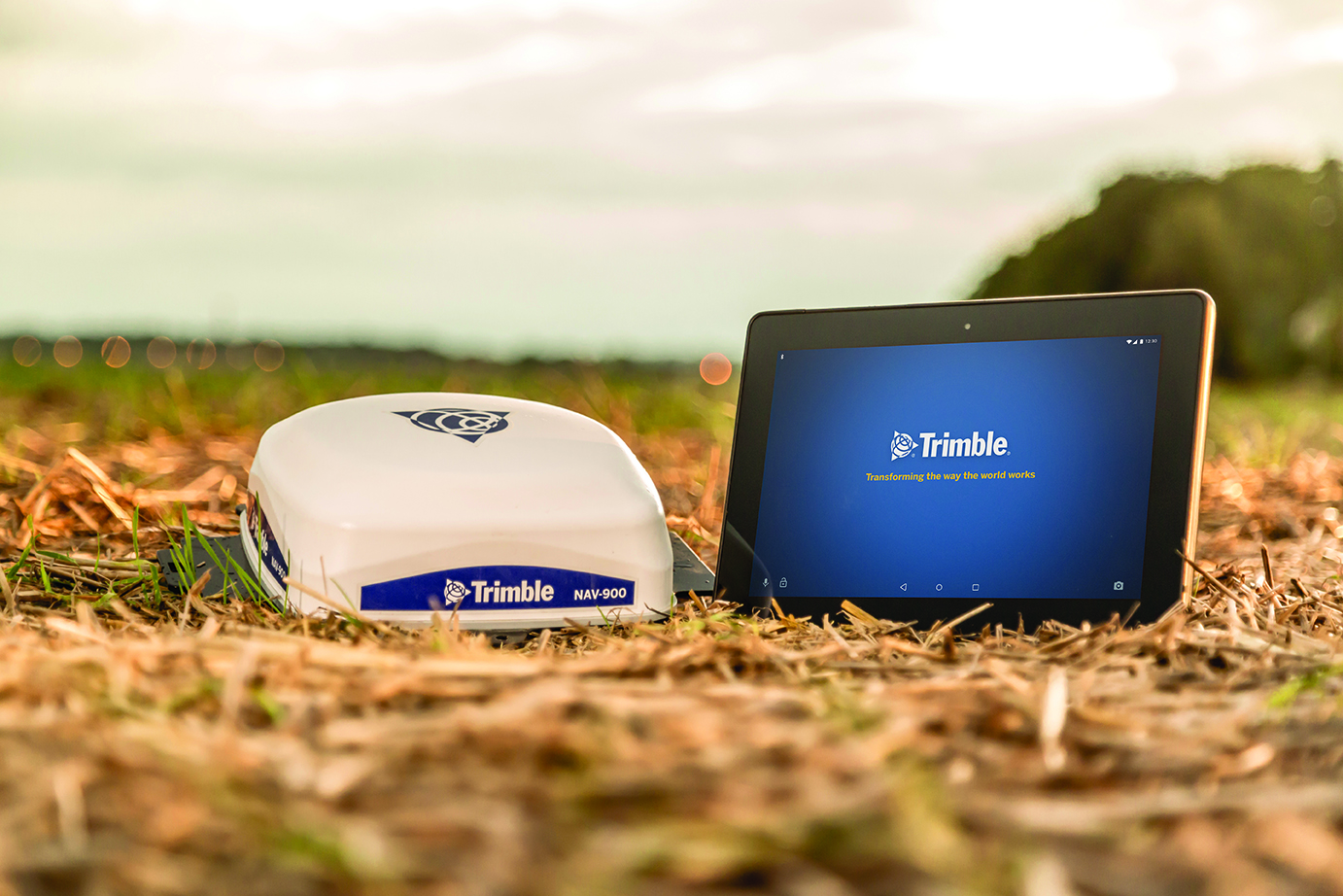
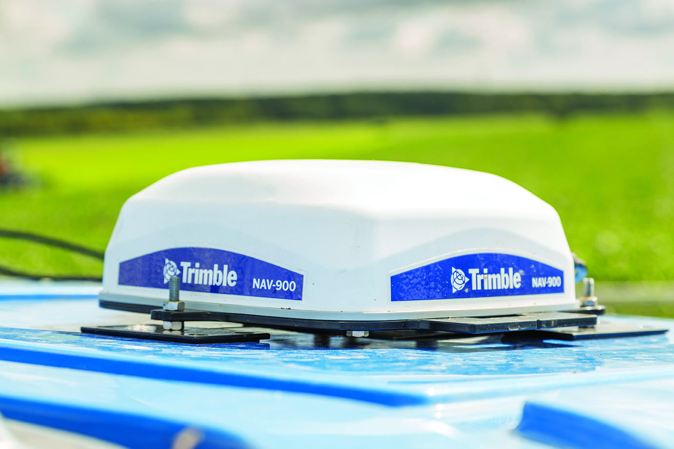
Nav 900 Guidance Controller
Nav-900
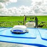
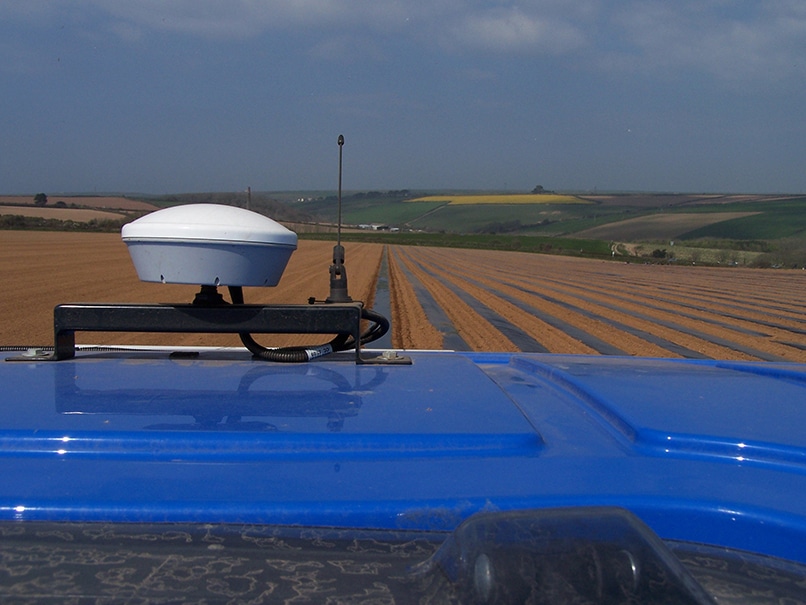
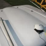
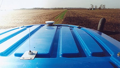
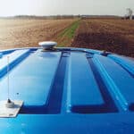
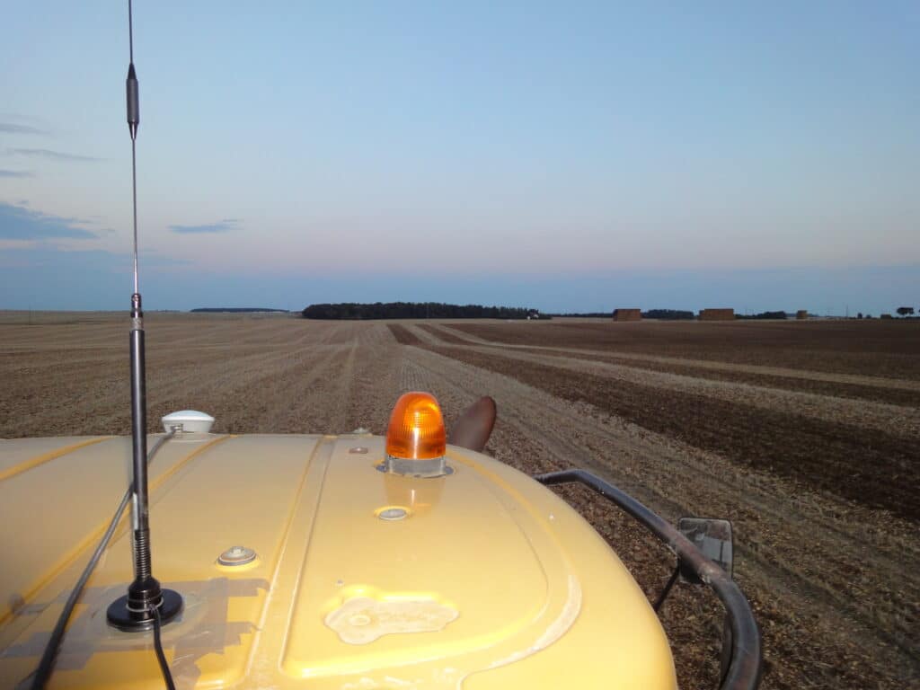
The NAV-900 guidance controller is our most advanced GNSS receiver to date, built for maximum uptime and a wide range of accuracy options from basic to high precision. It is designed to mount on the roof of most agricultural vehicles to provide positioning and guidance, including autosteer.
features
Full range of correction signals including GPS, GLONASS, Galileo, Beidou, and QZSS constellations
Built in WiFi and Bluetooth for tethering and device connections
Simplified setup with fewer components allows for an easier installation process and increased compatibility with CAN-based steering
Combine with one of the GFX series displays for auto guidance and precision farming functions
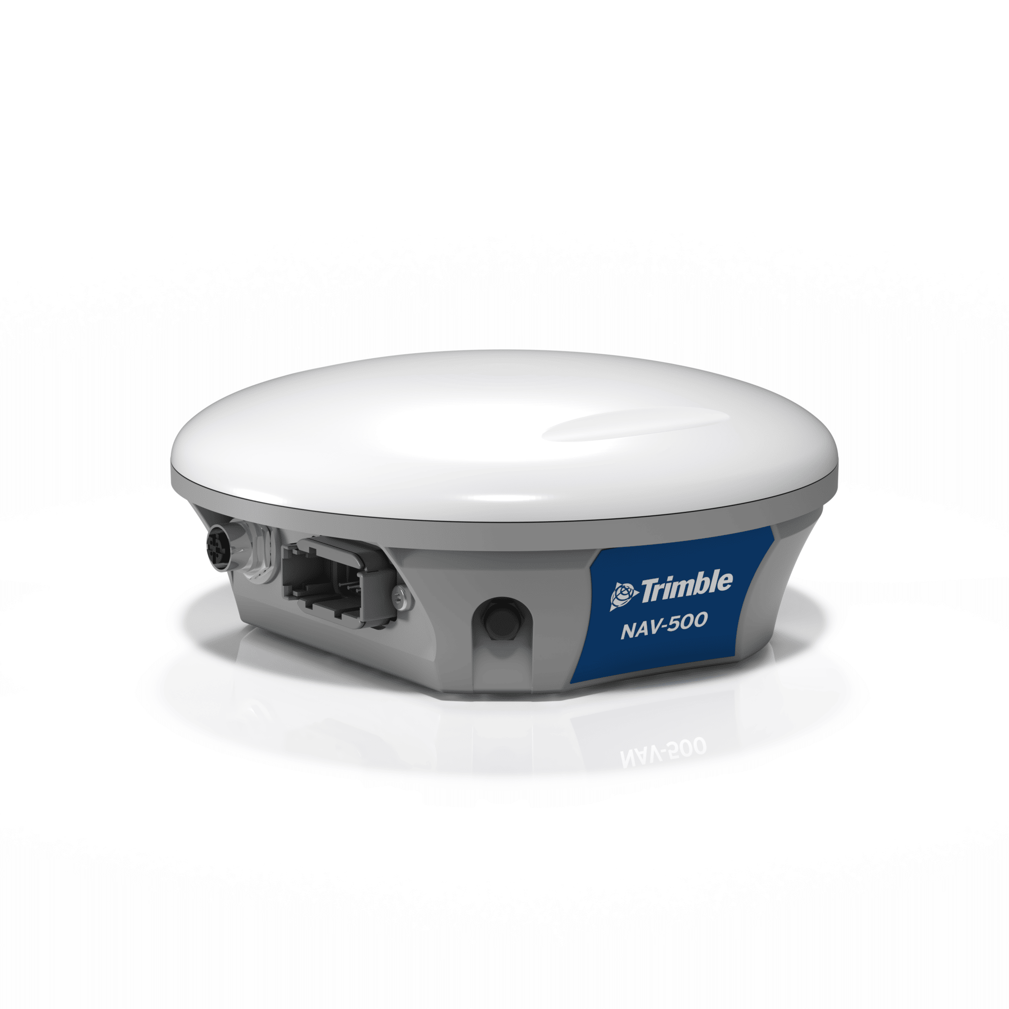
Paired with any GFX series display, the NAV-500™ guidance controller is an affordable precision solution capable of receiving corrections from multiple GNSS satellite constellations. Get sub-meter repeatable accuracy and full-farm coverage at a great price to use during tillage, broad-acre seeding, spraying and harvest.
features
Low-profile rugged housing
Trimble ViewPoint RTX™ corrections
5 satellite constellations
Roll-corrected manual guidance
Compatible with EZ-Steer® assisted steering system and EZ-Pilot® Pro steering system
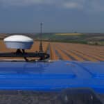
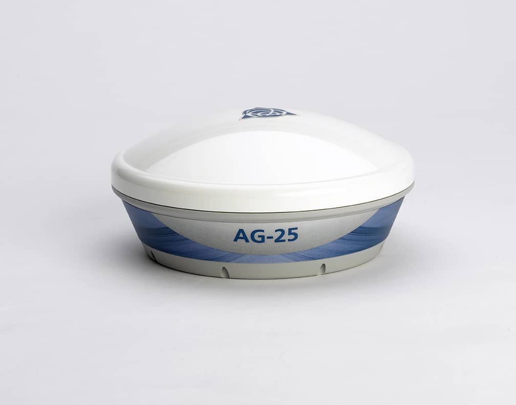
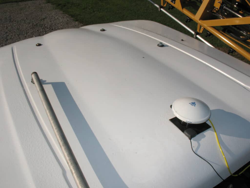
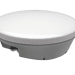
The Trimble AG25 Antenna is a general purpose GNSS rover antenna ideal for dynamic applications where position and heading are required. The AG25 offers excellent OmniSTAR (L-Band), GPS and GLONASS signal reception, making it ideal for use with the OmniSTAR G2 service as well as GPS/GLONASS positioning and heading applications.
features
Comprehensive GNSS support, including GPS modernization signals, GLONASS, BeiDou, and Galileo
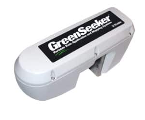
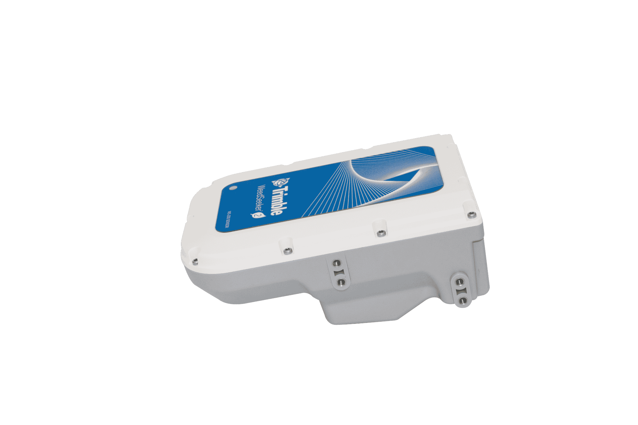
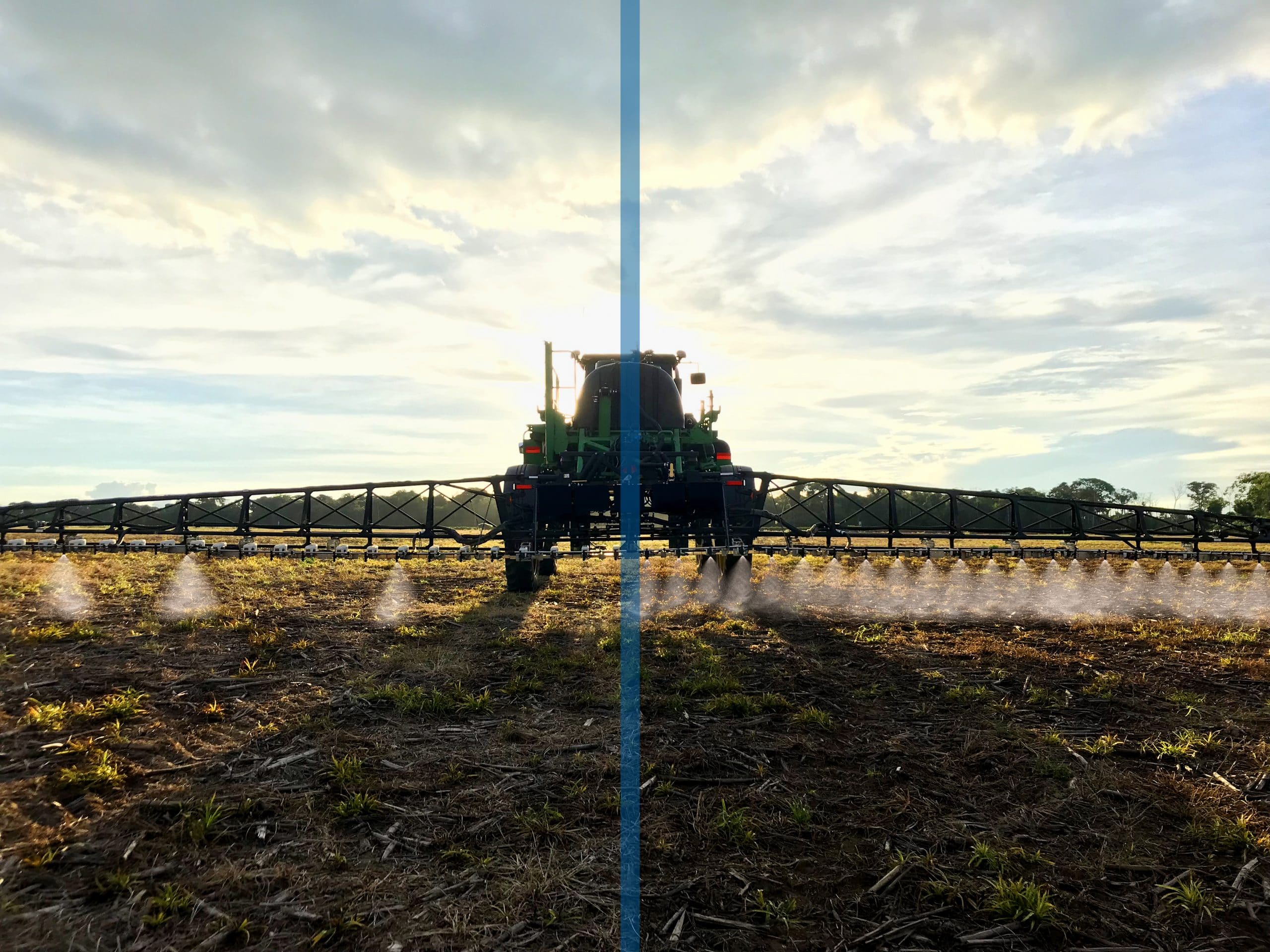
WeedSeeker® 2 is the next generation spot spray system from Trimble Agriculture. Redesigned for superior weed killing, it delivers all-around improved performance to previous solutions.
Using advanced optics and processing power, the WeedSeeker system detects and eliminates resistant weeds. When a weed passes underneath the sensor it signals its linked spray nozzle to precisely deliver herbicide and kill the weed, reducing the amount of chemical applied by up to 90%.
features
Building on more than 25 years of experience in the agriculture industry, the WeedSeeker® 2 system brings generational improvement to the spot spraying market. Growers now have a game changing solution to herbicide resistant weeds.
Intelligent sensor
Reduce herbicide usage by up to 90%
ISOBUS compatible
Unbeatable accuracy
Lightweight sensors and cabling
Universal mount for easy installation
Fewer sensors needed with expanded weed detection width
The WeedSeeker 2 spot spraying system is designed to save you money on weed control. WeedSeeker 2 only applies herbicide when a weed passes under the sensor. This cuts the amount of product needed to spray a field. Instead of spraying the entire field, you only spray weeds.
Use Trimble’s WeedSeeker 2 ROI calculator to compare how much it costs to spray your field with conventional spraying options, with the cost of spraying using WeedSeeker 2. Estimate your cost savings and the cost of a WeedSeeker 2 system for your sprayer, including how quickly the system will pay for itself.
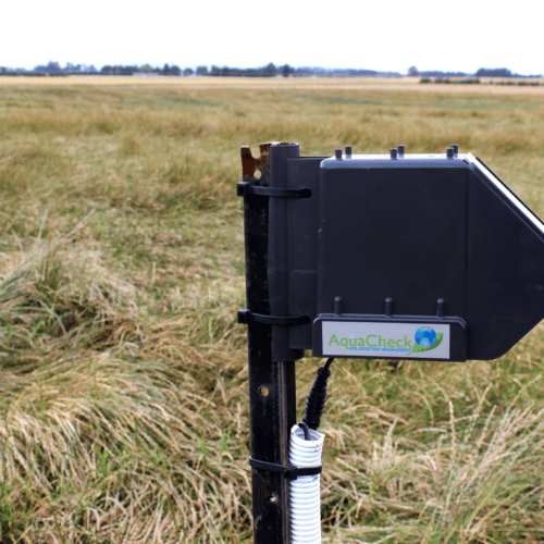
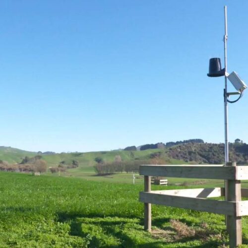
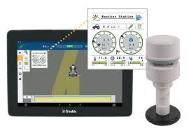
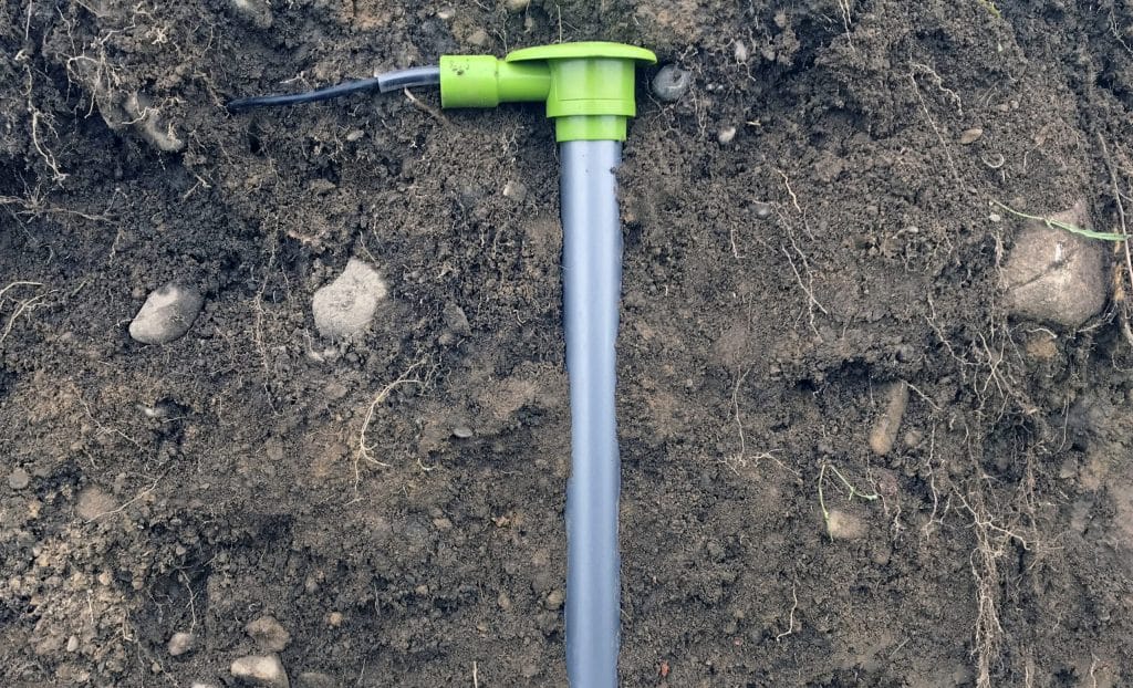
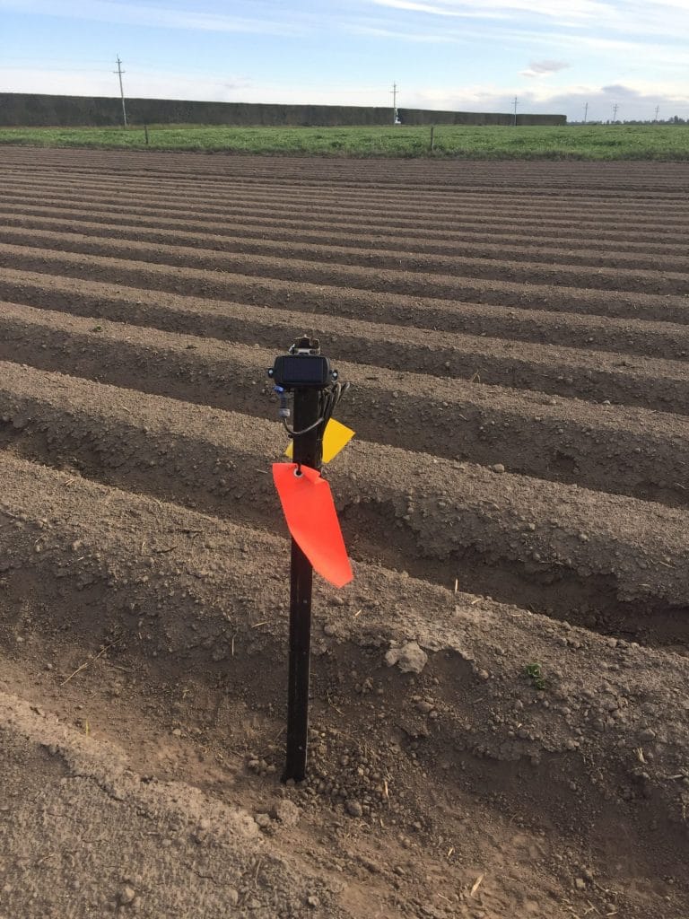
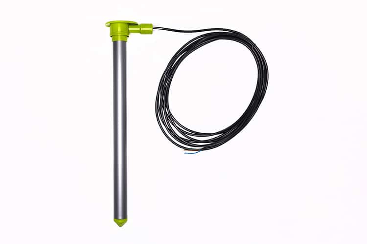
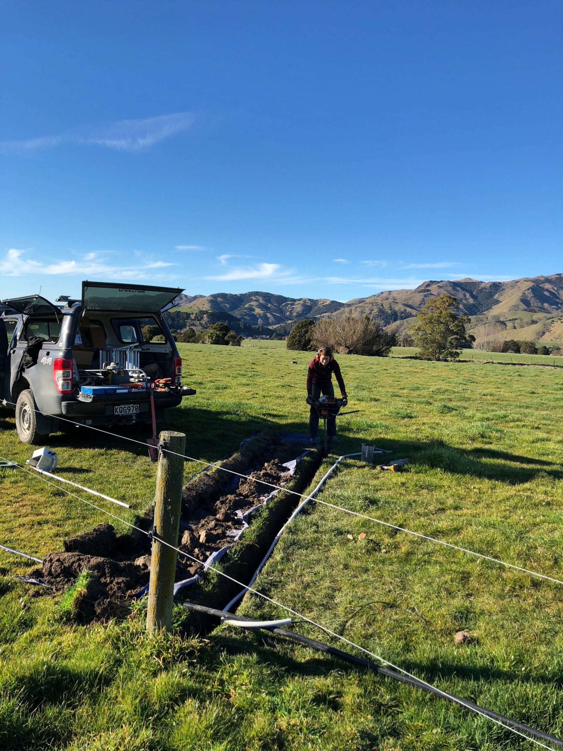
Soil moisture is one of the most critical elements for successful plant growth and profitable agriculture. We are lucky in NZ that, for the most part, we have adequate rainfall to produce high quality primary industry commodities . Unfortunately it just doesn’t fall where and when we need it. It’s our responsibility, as land stewards, to use this resource in the most efficient and effective way possible, ensuring that we’re applying enough to reach production targets while remaining environmentally sustainable.
Soil moisture is not only pertinent to irrigated farming though, it is fundamental to the success of all land-based primary industry sectors, even dryland. And at Vantage NZ, we wanted to bring a solution to New Zealand’s agriculturalists to help them manage this precious resource more efficiently, with a cost effective soil moisture monitoring solution.
FEATURES:
Fully telemetered, giving you wireless access wherever you are
Vertical orientation to easily see soil moisture movement within the profile
Built-in temperature sensors
Rain gauge connections optional
Easy to install and uninstall, making them great for seasonal cropping situations
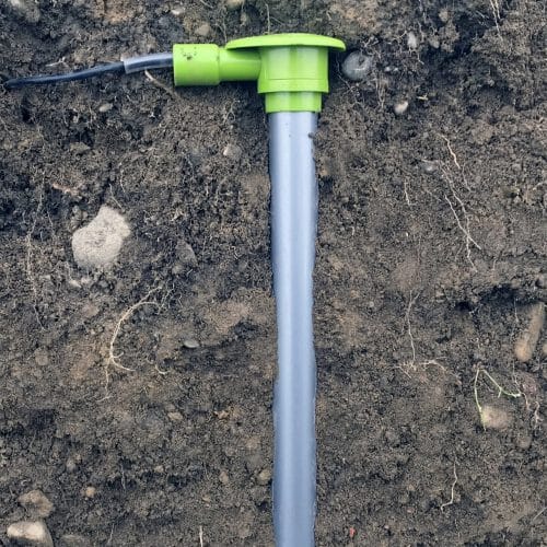
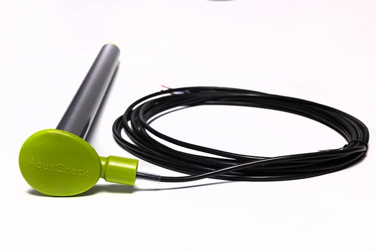
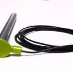
The AquaCheck soil moisture probe is jam packed full of great features positioning them as a leader in the soil moisture monitoring market around the world. Having timely and accurate soil moisture data is fundamental to running an efficient farming business.
It allows you to avoid over-watering and potential leaching of nutrients and wasting of energy, optimise crop growth by carefully managing your inputs, ensure responsible environmental management on your farm and ultimately take your irrigation management from a ‘guess game’ with a spade in a lot of cases, to an accurate measured approach which is likely to save time, money, water and nutrients while often increasing production
Why aquacheck
The AquaCheck probe is a high quality, affordable, capacitance based soil probe which is compatible with a range of telemetry options and end user platforms. The probes are a vertically-oriented probe that is easy to install. Typically, the AquaCheck probes have a soil moisture AND a temperature sensor every 10cm down their length, giving more information to make better farm management decisions.
All information from an AquaCheck probe is wirelessly telemetered to AquaCheckWEB a web based platform. The data can be viewed, recommendations and forecasts given for irrigation requirements or soil moisture trends going forward. Additionally, the data can also be pushed to other websites so that you can view your AquaCheck soil moisture data along-side other information that you may use for your irrigation scheduling, like weather station data.
AquaCheck has more than 40,000 probes installed in more than 20 countries around the world, highlighting that it’s a popular product, and here to stay to supply accurate and reliable soil moisture information to land stewards around the world.
The Trimble® GFX-350™ is the latest Android™ – based, easy-to-use display from Trimble Agriculture. This cost-effective solution offers great functionality and a simplified installation process, providing access to autosteering and application control for every farm.
Add in Bluetooth® and Wi-Fi connectivity to go along with ISOBUS compatibility and any grower can tackle farming applications from every season across all equipment brands.
FEATURES:
7′′ (17.8 cm) high-definition color touch-screen display
Android-based operating system allows you to customize the display for the way you work
Rugged construction for everyday field use, meeting demands in harsh environments
Compatible with NAV-500 and NAV-900 guidance controllers


