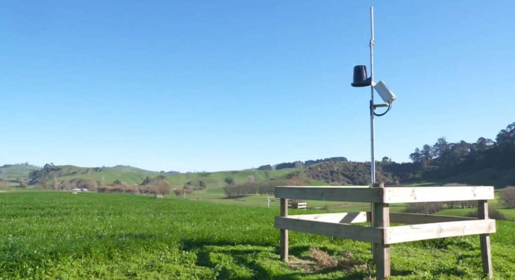
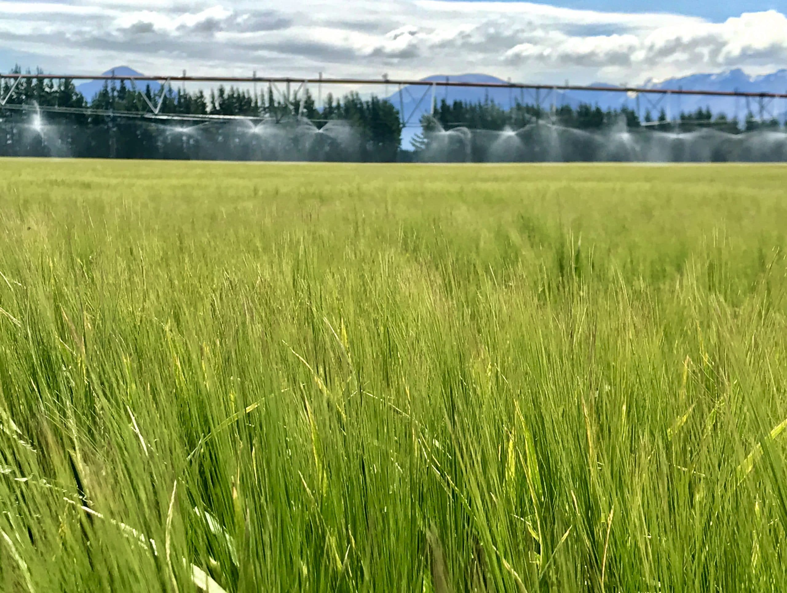
Soil moisture is one of the most critical elements for successful plant growth and profitable agriculture. We are lucky in NZ that, for the most part, we have adequate rainfall to produce high quality primary industry commodities . Unfortunately it just doesn’t fall where and when we need it. It’s our responsibility, as land stewards, to use this resource in the most efficient and effective way possible, ensuring that we’re applying enough to reach production targets while remaining environmentally sustainable.
Soil moisture is not only pertinent to irrigated farming though, it is fundamental to the success of all land-based primary industry sectors, even dryland. And at Vantage NZ, we wanted to bring a solution to New Zealand’s agriculturalists to help them manage this precious resource more efficiently, with a cost effective soil moisture monitoring solution.
Soil Moisture Solutions
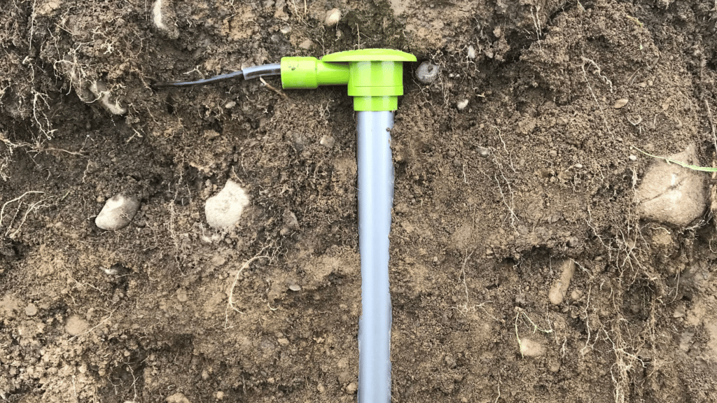
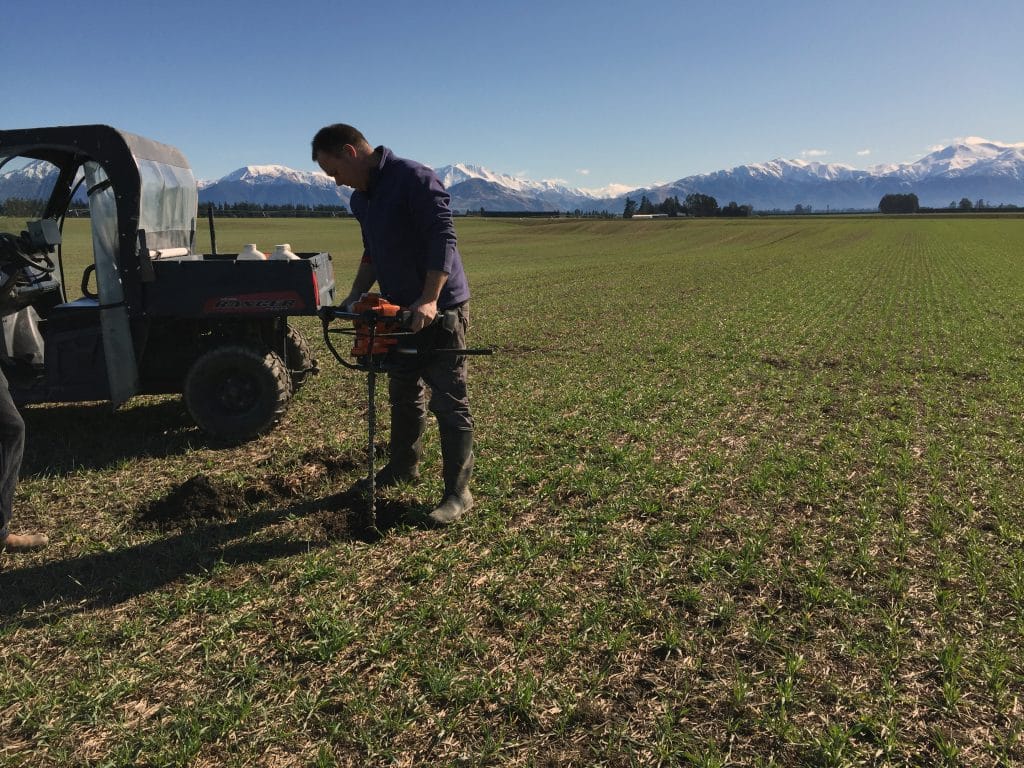
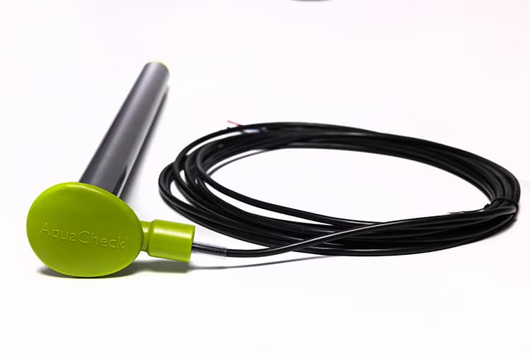
AquaCheck Soil Moisture Probes
AquaCheck
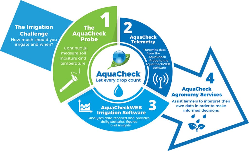
The AquaCheck soil moisture probe is jam packed full of great features positioning them as a leader in the soil moisture monitoring market around the world. Having timely and accurate soil moisture data is fundamental to running an efficient farming business.
AquaCheck soil moisture probes are a robust, well-priced and easy-to-use soil moisture solution for New Zealand farmers.
features
Fully telemetered, giving you wireless access wherever you are
Vertical orientation to easily see soil moisture movement within the profile
Built-in temperature sensors
Rain gauge connections optional
To learn more about the AquaCheck probes click here…
Soil Moisture Solutions
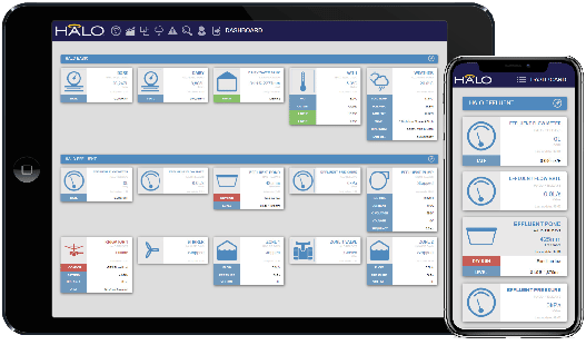
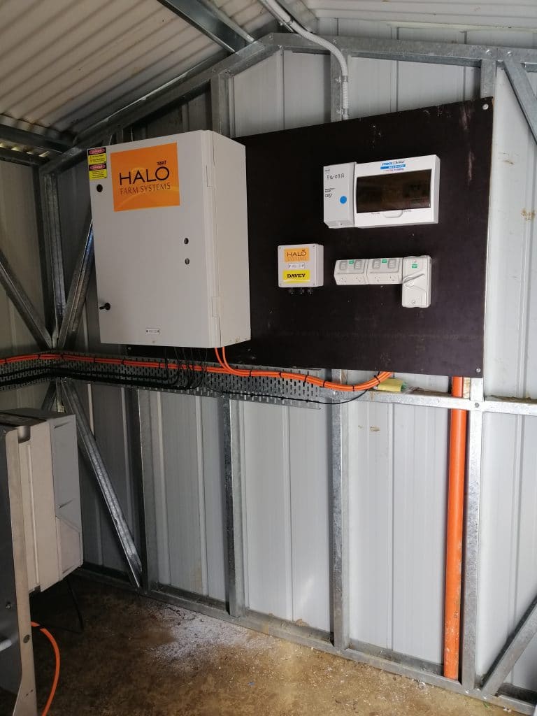
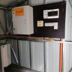
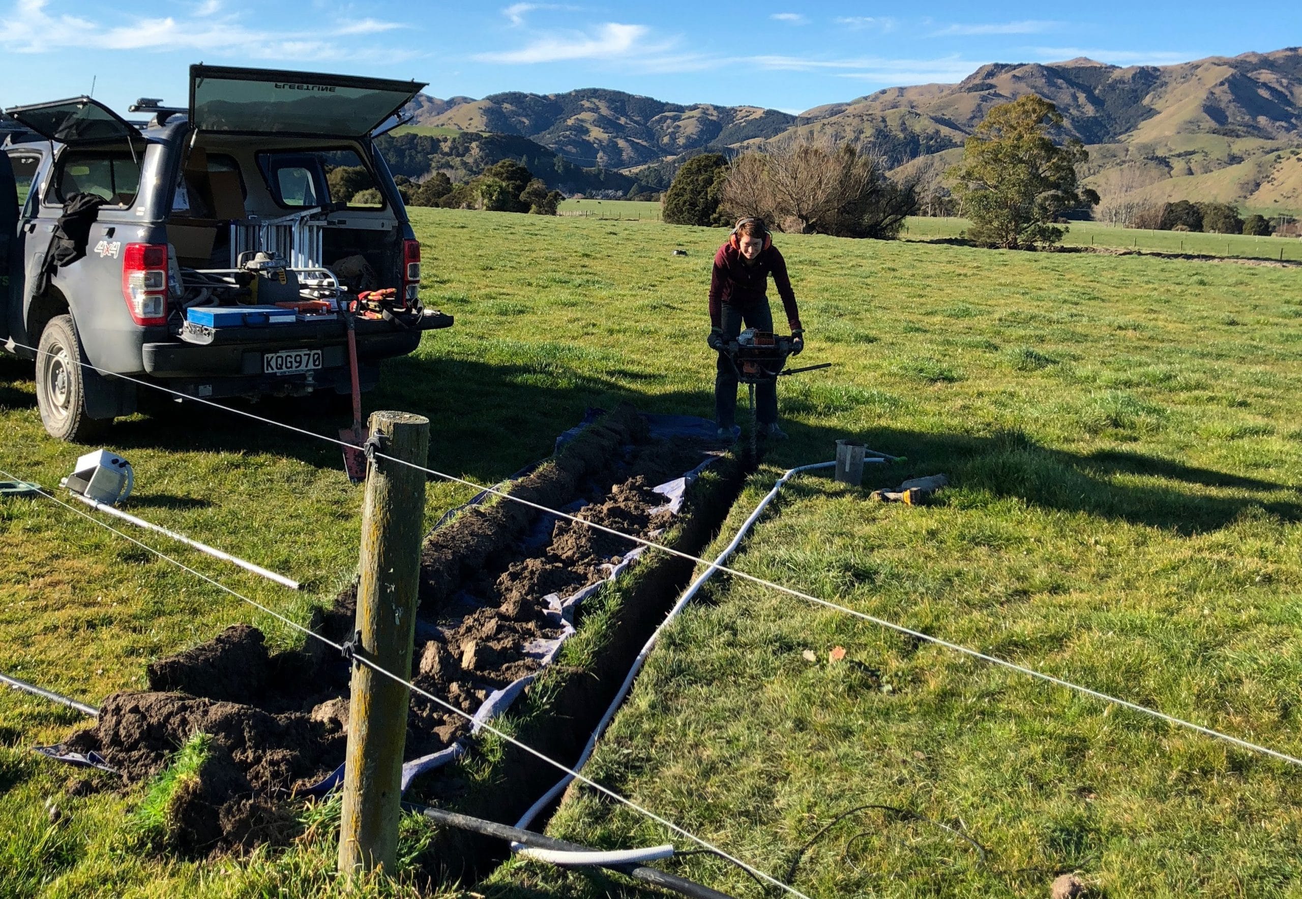
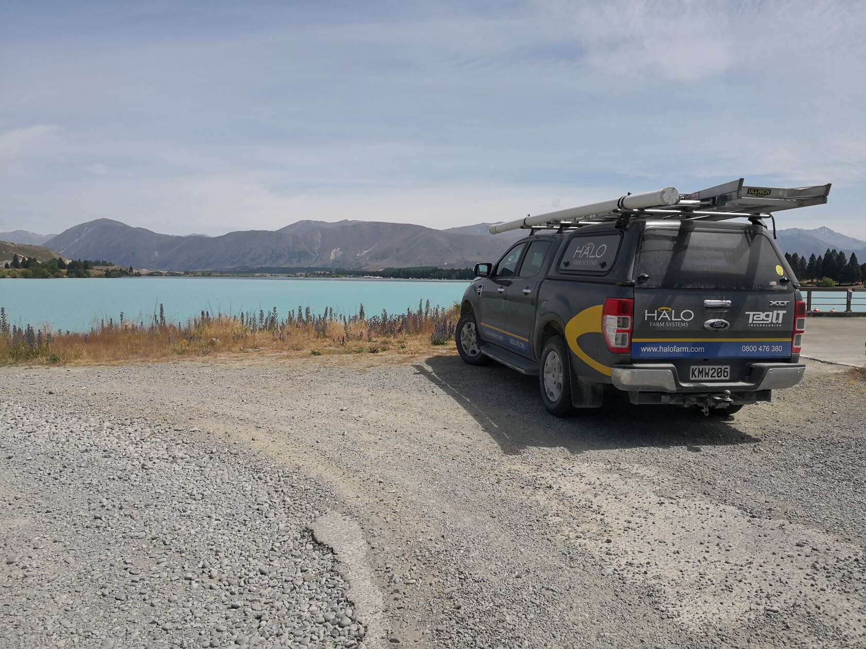
Halo Water Management
HALO
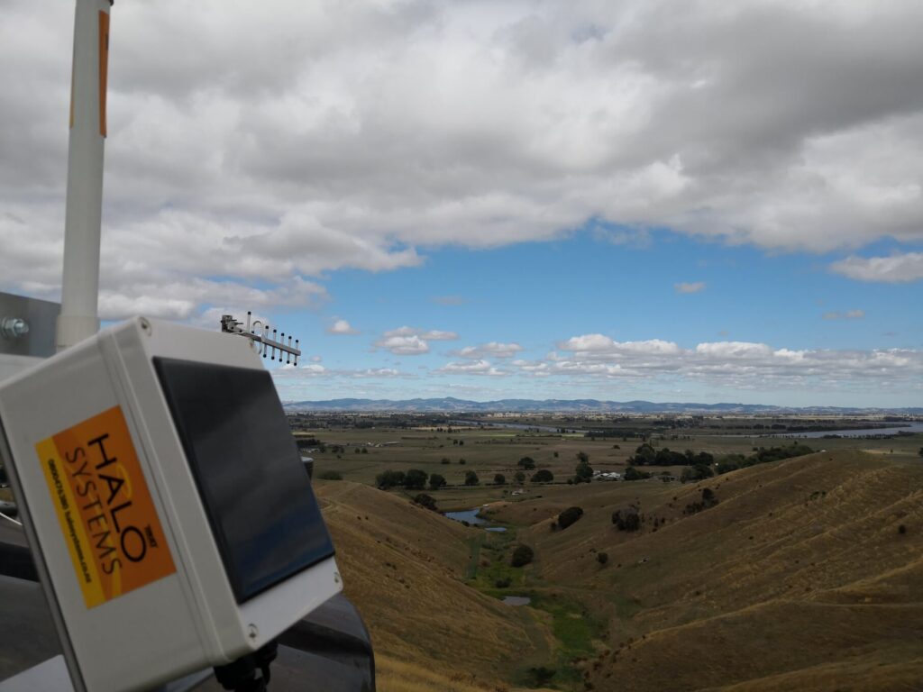
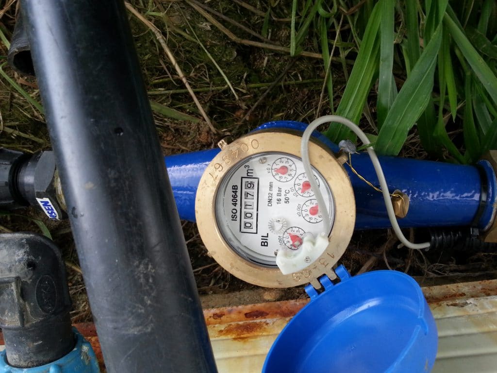
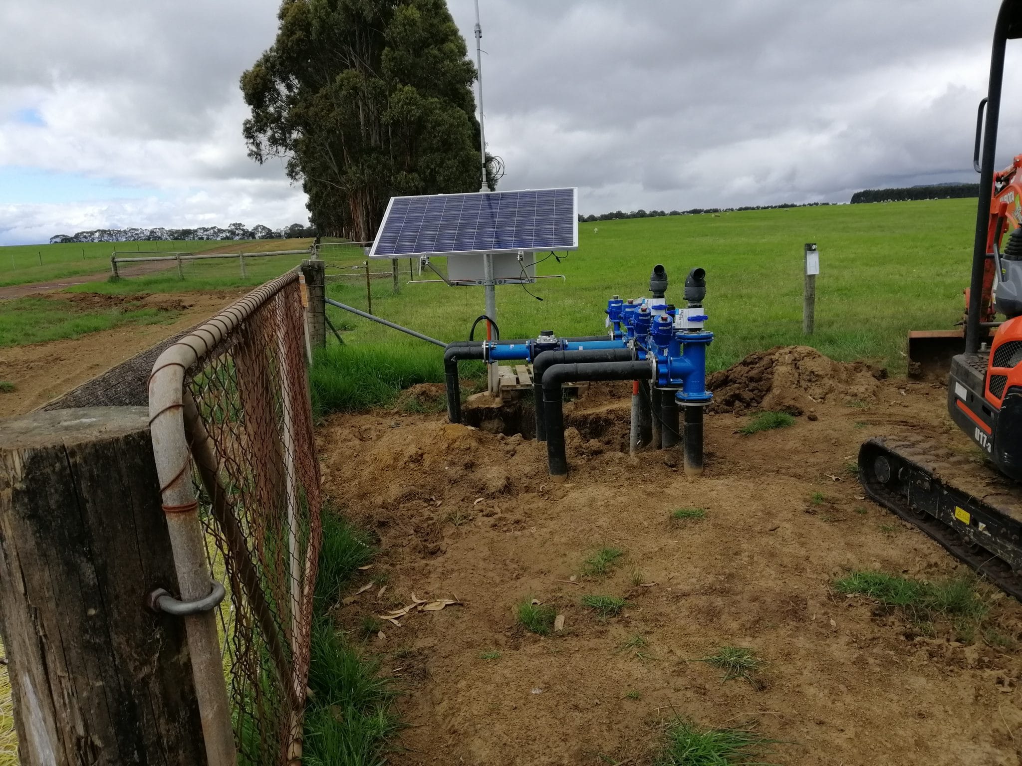
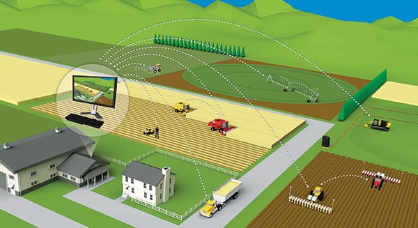
HALO uses state of the art hardware and software to run systems tailored to your specific needs. They set up a data gateway in the most practical location and connect the range of sensors needed to meet your requirements. Solar powered or mains powered and with both cellular and internet connectivity options HALO can work anywhere, any time.
Vantage NZ partners with HALO to add value to your soil moisture needs by ensuring you’re set up with an eye to the future. The HALO system not only supports a wide range of sensors, control systems and applications to help you manage soil moisture, they also offer complete monitoring and control solutions for your whole farm.
features
Farm-wide command and control networks
Can integrate with a wide range of sensors and devices
Ensures all your important farm information is provided on one dashboard so you can keep your finger on the pulse
To learn more about the full HALO offering click here…
HALO systems is dedicated to providing innovative solutions to remote monitor and control your important infrastructure. Their twenty year history includes hundreds of successfully installed systems.
HALO uses state of the art hardware and software to run systems tailored to your specific needs. They set up a data gateway in the most practical location and connect the range of sensors needed to meet your requirements. Solar powered or mains powered and with both cellular and internet connectivity options HALO can work anywhere, any time.
HALO has a large range of proven applications from dairy farms to factories, they can also provide customised wired and wireless solutions for any industry applications.
Soil Monitoring System
Soil Moisture Monitoring
Soil moisture is one of the most critical elements for successful plant growth and profitable agriculture. It’s our responsibility as land owners and managers that we use rainfall in the most efficient way possible, ensuring that we’re not over-irrigating and leaching nutrients, but not under-irrigating and reducing production. Soil moisture is not only pertinent to irrigated farming though, it’s fundamental to the success of all land-based primary industry sectors, even dryland.
Vantage NZ partners with HALO to add value to your soil moisture needs by ensuring you’re set up with an eye to the future. The HALO system not only supports a wide range of sensors, control systems and applications to help you manage soil moisture, they also offer complete monitoring and control solutions for your whole farm. If you want to measure and manage it all in one platform, the HALO solution is for you.
Other Popular Halo Solutions
Milk Vat Monitoring:
HALO’s MVMS System monitors milk volume, milking start/stop time, vat temperature, milk inlet temperature, power monitoring + ongoing support.
Effluent Monitoring & Control:
Designed to give you full control and allow easy upgrades as your circumstances suit. HALO can provide your solution to the telemetry requirements on farm that support your consent requirements.
Weather Monitoring:
If you need accurate local weather information, then a HALO weather station is the answer. These can be single or multi-site weather stations on your property that give you live, up-to-the-minute data on exactly whats happening on your farm, including rainfall, soil moisture levels, ambient and soil temperature as well as wind direction and speed.
Irrigation Control:
There are a wide range of irrigation systems and applications. Whether it be moving, indoor, or outdoor HALO have the sensors, application, and experience to fulfill your needs.
Frost Protection:
Protecting your crop from frost damage can be costly and time consuming. The HALO team can evaluate your current infrastructure and create a system to allow you to monitor and control your system from the comfort of your own home. They have a wide range of options and can put together a package to suit your needs.
Silo Monitoring:
If you’re after a simple, low cost way to keep an eye on your silo level then we have the answer. Connect the LevAlert to a HALO unit and get text and e-mail alerts whenever the contents in the silo fall below the device. For total volume, use the HALO laser silo level to show how full your silo is. Alerts can be generated when the silo falls below a level you decide.
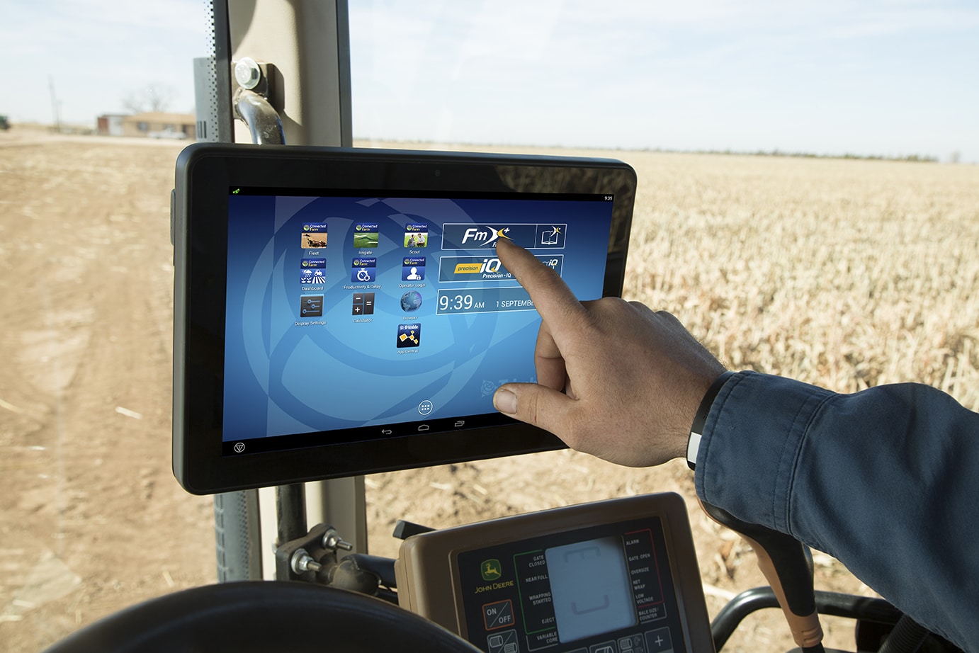
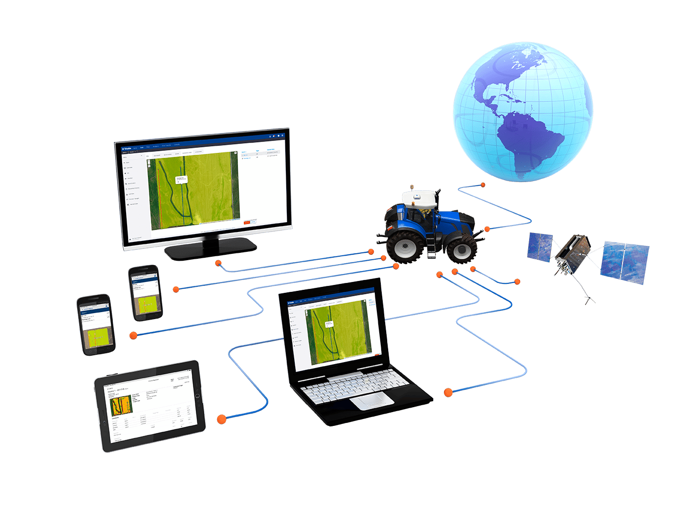
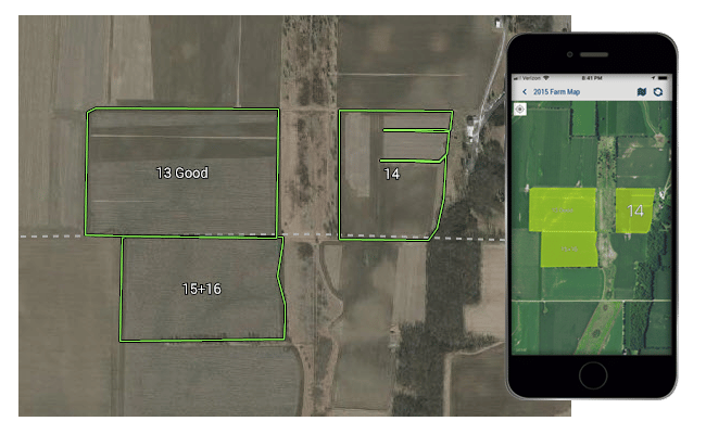
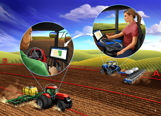
Farming is hard enough. That’s why Trimble created AutoSync™, a new feature that works in the background to automatically sync vital farm data so everyone in the farm operation is working off the same playbook.
AutoSync automatically syncs guidance lines, field names, boundaries, materials, implements, vehicles, and operator information across all connected devices in your farm operation — including Trimble® TMX-2050™ and GFX-750™ displays, as well as the Trimble Ag Software that you can access from any computer or mobile device.
AutoSync is included with Farmer Core and Farmer Pro software licenses.
features:
Create, edit, and delete data from your Trimble display (using Precision- IQ™) or Trimble Ag Software and have it automatically update your other connected devices
Set permissions that allow or prevent operators from creating, editing, and deleting data from the Trimble display
Save your vehicle profiles to Trimble Ag Software for restoring your vehicle settings if they are lost, eliminating re-calibration
Save Time— Avoid chasing USBs for transferring data between displays and office, increasing overall efficiency
Reduce Human Error— Improve integrity of records by eliminating errors caused by multiple entry of guidance lines, field names, field boundaries, and materials
Leverage Two-Way Data Transfer — Powered by AutoSync, Trimble Ag Software solutions enable automatic two-way data transfer with supported displays
Satisfy Regulatory and Contractual Requirements— AutoSync enables easy creation of application coverage maps (proof of placement reports)
AutoSync requirements:
Trimble TMX-2050™ (utilising Precision-IQ™ software) with firmware 6.11 or higher or Trimble GFX-750™ display using firmware 2.11 or higher. Trimble FmX® utilising the FmX+ software, and CFX-750™ Office Sync users will continue to have access to the same Office Sync features. AutoSync is not supported on non-Precision-IQ displays.
Display Connection service for each connected Trimble display.
Wireless connectivity for Trimble displays, such as cellular or wifi connections.
Trimble Ag Mobile app with version 3.2 or higher.
Trimble Ag Software license (Farmer Core or Farmer Pro).
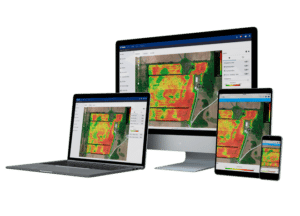
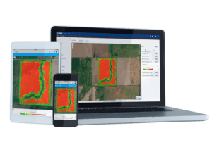
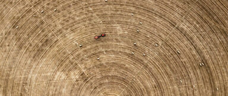
Crop Health Imagery, powered by PurePixel™ technology, provides reliable, cloud-free, calibrated satellite images to farmers and their trusted advisors. PurePixel leverages a proprietary algorithm to analyze multiple sensor inputs to produce calibrated vegetative index maps throughout the growing season.
This unique calibration allows farmers to compare crop health at each growing stage for more targeted crop scouting. This enables smart in-season application decisions, helping farmers maximize yields and drive profits.
Crop Health Imagery is included with Farmer Pro and is available worldwide.
Leverages Landsat 8, Sentinel 2A and Sentinel 2B satellites, providing on average 3-5 cloud-free images per month
Access imagery throughout the growing season once the add-on module is activated and a field boundary and crop is assigned to the field
Receive four types of imagery for each field: vegetative index-calibrated, vegetative index-classified, natural color, and infrared color
Why pure pixel?
Crop Health Imagery at your fingertips
Imagery Calibration Done Right:
Many imagery providers fail to address the need to compare one growth stage to the next using a calibrated scale. Trimble’s offering is unique because Crop Health Imagery is powered by PurePixel, which leverages a proprietary algorithm that can analyze multiple sensor inputs to produce calibrated vegetative index maps. This means you’ll have reliable imagery throughout the growing season using the same scale, helping you find issues quicker.
Pinpoint the Problem Spots:
Crop Health Imagery provides the ‘early warning’ system to see trouble before it costs you money. Seeing your crop performance across the entire field for that single point in time can help you detect issues before they escalate into bigger problems. Crop Health Imagery is your partner in maximizing profit in each area of your field.
Use Your Imagery for Targeted Scouting:
All imagery can be viewed from the Trimble Ag Mobile app to help target specific locations for scouting. Using the app, navigate to troubled areas and enter scouting information such as pest types and photos. Data uploads to your Trimble account can be easily shared with a trusted advisor, resulting in timely recommendations.
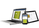
Farmer Pro is Trimble’s most powerful online and mobile farm management software. Farmer Pro customers get additional features that enable innovative, profitable farm management, including Crop Health Imagery, Work Orders, grid or zone soil sampling workflows, grain contract management, and more.
Farmer Pro comes with access to an intelligent, user-friendy online platform that syncs automatically across devices so you’re only entering information once. Growers can use the online platform for:
Field record keeping
Real-time fleet tracking and utilisation
Field map layering
Field data and profitability analysis
Mobile Farm Management Made Easy
Farmer Pro comes with access to the pioneering, user-friendly Trimble Ag Mobile app. Trimble Ag Mobile allows farmer t input, access, and share records – from field images to crop scouting reports – in real time from any mobile device. Trimble’s farm data management app works on both Apple iOS and Adroid devices, and keeps working even if you lose your Wi-Fi or cell signal.
Use Trimble Ag Mobile for:
Field record keeping
Fleet management
Work orders
Crop scouting
Soil sampling
Grain contracts and bin management
Crop Health Imagery
Crop Health Imagery, powered by PurePixel™ technology, provides reliable, cloud-free, calibrated satellite images to farmers and their trusted advisors. PurePixel leverages a proprietary algorithm to analyze multiple sensor inputs to produce calibrated vegetative index maps throughout the growing season.
This unique calibration allows farmers to compare crop health at each growing stage for more targeted crop scouting. This enables smart in-season application decisions, helping farmers maximize yields and drive profits.
AutoSync
Farmer Pro comes with the AutoSync™ feature, which works in the background to automatically sync farm data across Trimble Ag Software and all Trimble displays using the Precision-IQ™ field application. Once enabled, this powerful feature syncs guidance lines, field names, boundaries, materials, implements, vehicles, and operator information in minutes, without pressing a button. AutoSync reduces human error and eliminates the need to manually share data via USB, resulting in consistent, accurate farm records.
Trimble xFill, powered by RTX technology, is your backup to VRS and RTK corrections. It provides seamless, centimeter-level back-up positioning for up to 20 minutes when faced with poor radio connectivity or cellular interruptions. An xFill premium subscription provides unlimited backup time, ensuring the highest efficiency in the field. Watch your productivity, and your profits, grow.
FEATURES:
Absolute accuracy: provides continued accuracy to less than 2.5 centimeter levels during signal interruptions
Predictable backup: 20 minute backup included with compatible devices. Unlimited coverage is available with a premium subscription
Powered by Trimble RTX technology: Trimble xFill runs seamlessly in the background automatically bridging the gap if a users RTK or VRS correction source is interrupted due to cellular signal disruption or loss of radio connectivity
More Uptime: Continue working through signal outages with centimeter-level accuracy* using Trimble xFill, minimising work delays and improving in-field productivity
xFill: Free for the first 5-20 minutes (application dependent) after the loss of an RTK correction source on all compatible devices
xFill Premium: maintains centimetre-level accuracy indefinitly beyond 20 minutes. A Trimble xFill Premium subscription is required.
Keep working – maintain centimeter-level precision during signal disturbances
Minimise disruptions – Trimble xFill instantly switches over after RTK correction loss, minimising disruptions to your work and increasing your yields and profits
Work everywhere – satellite coverage makes Trimble xFill available worldwide, the ideal solution for providing reliable backup in remote locations or areas with poor cell coverage
Multi-satellite support – GPS, GLONASS, Galileo, BeiDou, and QZSS enabled for ultimate reliability and performance, worldwide
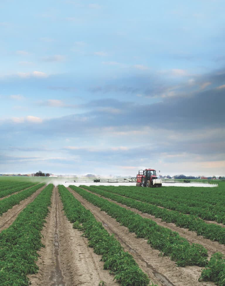
Trimble CenterPoint VRS provides instant access to RTK-level positioning within a fixed network. With sub-inch accuracy, this agriculture GNSS correction service helps you achieve the quality standards you need in less time for tasks such as drainage, drip irrigation and land levelling in areas with good cell coverage. Watch your productivity, and your profits, grow.
FEATURES:
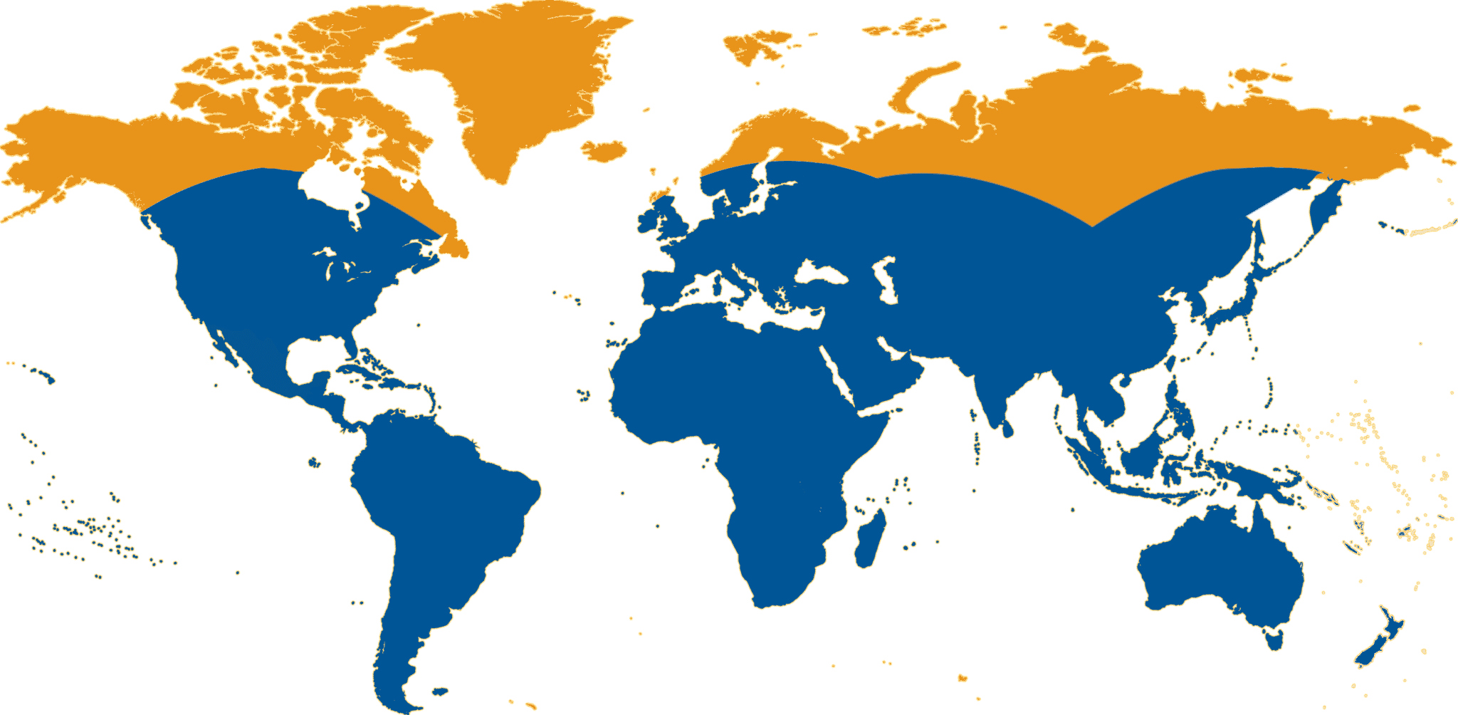
Availability: United States, Europe and Australia/New Zealand
High Accuracy: Provides < 2.5 cm (1″) accuracy*
Ideal for a variety of high precision agriculture uses in areas having good cellular coverage
Instant Initialisation: Start working immediately under optimal conditions**
Multi-constellation support: GPS, GLONASS and QZSS enabled
More uptime: Built-in redundancy to ensure connectivity, consistency and quality
No base station required: No need to worry about losing radio signal reception since a base station is not needed for Trimble VRS Now-based correction services
* 95% performance based on in field measurements. Achievable accuracy and initialization time may vary based on type and capability of receiver and antenna, user’s geographic location and atmospheric activity, scintillation levels, GNSS constellation health and availability and level of multipath including obstructions such as large trees and buildings.
other benefits:
High accuracy – with accuracy levels < 2.5cm, you can get your job done fast and on the line, first time
Better uptime – dropped signals are a thing of the past. Trimble’s reliable networks ensure you’re always on and working so you can keep on producing without interruption
Boarder availability – VRS Now networks are available throughout much of North American, Europe, New Zealand and Australia, and the footprint continues to expand
Less hassle – don’t worry about buying, moving or maintain a base station or setting up your own infrastructure. Just connect, correct and work
xFill Compatible – Maintain seamless metwork connections with Trimble xFill, your satellite delivered backup coverage if network connectivity is lost
Trimble RangePoint RTX is an affordable, entry-level alternative to free-to-air (SBAS) satellite systems that provides <50cm repeatable accuracy via satellite or cellular delivery worldwide. Agriculture customers can achieve 15cm pass to pass accuracy. This advanced technology in agriculture helps you achieve the quality standards you need in less time when broad-acre farming.
FEATURES:
Availability: Worldwide via satellite accessibility
Broad Accuracy: Provides 15 cm (6″) pass to pass accuracy and 50 cm (20″) repeatable accuracy*
Ideal for broadacre applications: like spraying, spreading and cultivation
Quick Initialisation to full accuracy in less than 5 minutes**
Multi-constellation support: GPS, GLONASS, Galileo, QZSS and BeiDou enabled for ultimate reliability and accessibility
More uptime: Continue working through correction signal interruptions for up to 200 seconds
No base station required: No need to worry about losing radio signal reception since a base station is not needed for Trimble RTX-based correction services
Cost Effective: No additional data or cellular plans required
* 95% performance based on in field measurements. Achievable accuracy and initialization time may vary based on type and capability of receiver and antenna, user’s geographic location and atmospheric activity, scintillation levels, GNSS constellation health and availability and level of multipath including obstructions such as large trees and buildings.
other benefits
Necessary precision – with a 15cm pass to pass accuracy, you can get your job done right the first time with the consistent row spacing
Keep working – dropped signals are a thing of the past. Trimble’s reliable networks ensure you’re always on and working so you can keep on producing without interruption
Reliable service – A base station isn’t required, meaning there’s no need to worry about losing radio signal connectivity, or losing time on the job
Work anywhere – with RTX you can farm anywhere whether you’re in a remote location or large geographic area
Trimble ViewPoint RTX, an affordable, entry-level alternative to free-to-air (SBAS) satellite systems that provides 30 cm pass-to-pass accuracy; giving farmers a more stable signal with the same ease of use. This advanced technology in agriculture helps you achieve the quality standards you need in less time when broad-acre farming.
FEATURES:
Entry-level precision: provides sub-meter accuracy for jobs that require modest precision such as broad-acre farming, boundary mapping, or large asset locations
Keep working: continue working through correction signal interruptions for up to 200 seconds. Get more work done in the day with fewer delays
Multi-satellite support: GPS, GLONASS, Galileo, BeiDou, and QZSS enabled for ultimate reliability and accessibility
Fast initalisation: converges to full accuracy in less than 5 minutes
Broad accuracy – with 30cm pass to pass accuracy, you can get your job done right, the first time with the consistent row spacing
Better uptime – dropped signals are a thing of the past. Trimble’s reliable networks ensure you’re always on and working so you can keep on producing without interruption
Reliable service – A base station isn’t required, meaning there’s no need to worry about losing radio signal connectivity, or losing time on the job
Work everywhere – satellite coverage makes Trimble xFill available worldwide, the ideal solution for providing reliable backup in remote locations or areas with poor cell coverage
Trimble CenterPoint RTX for Agriculture is built on Trimble’s exclusive RTX technology, providing repeatable high-accuracy GNSS positioning via satellite or cellular delivery worldwide. It helps you achieve the quality standards you need in less time for strip tilling, planting and seeding, spraying, spreading and more. Watch your productivity and profits grow.
FEATURES:
Availability: Worldwide
High Accuracy: Provides < 2.5cm horizontal accuracy*
Quick initialisation: CenterPoint RTXconverges to full accuracy in <20 minutes,** see coverage map for details
No base station required: No longer worry about losing radio signal connectivity since a base station is not required for Trimble RTX-based correction services
Cost Effective: No additional data or cellular plans required
Fast Restart (Agriculture) and Quick Start (Survey): Decrease the standard** initialisation time to less than 5 minutes at the beginning of each day by starting your tractor in the same place you shut it off the night before
Benefit for farming: Achieve greater productivity in the field when planting, spraying or spreading. High accuracy, Trimble CenterPoint RTX, can reduce overlap by 90% – 95%. This equates to up to a 5% savings on input costs.***
* All horizontal accuracy specifications are based on in-field performance 95% of the time.
** Receiver convergence time varies based on GNSS constellation health, level of multipath, and proximity to obstructions such as large trees and buildings.
*** As compared to planting using a guidance system or guidance system with SBAS corrections with a 40 ft planter. Results may vary based on equipment, field size and other conditions.
other benefits
High accuracy – provides better than 2.5cm at 95% absolute, repeatable horizontal accuracy
Better uptime – dropped signals are a thing of the past. Trimble’s reliable networks ensure you are always on and working so you can keep on producting without interruption
Reliable service – a base station isn’t required, meaning there’s no need to worry about losing radio signal connectivity, or losing time on the job
Work anywhere – with RTX you can farm anywhere whether you’re in a remote location or have paddocks scattered over large geographic areas
Fast initialistion – converges to full accuracy in <20 minutes


